Cacapon River
Concern about these issues led to the establishment of the Cacapon Institute in 1985 (originally known as the Pine Cabin Run Ecological Laboratory).
[citation needed] The Cacapon River emerges from underground in a gap in Sandy Ridge (1683 feet/513 m) west of Wardensville.
It is actually the reemergence of the Lost River, which sinks into an underground channel east of McCauley near the entrance to Camp Pinnacle.
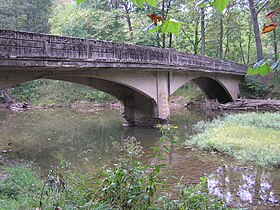
Waites Run, a tributary draining some of the western slopes of Great North Mountain enters the Cacapon River near the bridge on Rt.
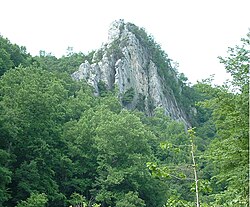
From the county line, the river is bounded to its east by the George Washington National Forest and to its west by Baker Mountain (2024 feet/617 m).
To its east, the river is paralleled by Christian Church Road (West Virginia Secondary Route 13), on which is located the 18th century Capon Chapel.
After its confluence with Mill Branch, the Cacapon River bends through the small historic town of Capon Bridge.
From Forks of Cacapon to Largent, the river creates a number of horseshoe bends between Sideling Hill (2021 feet/616 m) and Little Mountain (1429 feet/435 m).
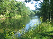
This stretch of the Cacapon River is also mostly undeveloped and forested with the exception of a gated community, The Crossings, located between the WV 127 bridge and Largent.
Variants include:[1] All locations listed below are designated public access sites by the West Virginia Division of Natural Resources at their website.