Callawassie Island
The island is ten to twelve miles inland from the Atlantic Ocean in the estuarial system of the Port Royal Sound and is entirely surrounded by salt marshes and tidal creeks.
[9] The South Carolina coastal area known as the "Lowcountry" is geographically composed of: multiple sea islands, deep natural harbors, meandering estuaries which extend for miles inland, and tidal marshlands, populated by unique flora, as well as reptilian and aquatic ecosystems.
[11] Archeological discoveries of artifacts ranging from cooking utensils, hunting and construction implements, and human remains have been unearthed from 102 registered historic sites found on the island.
[12][13] Multiple shell refuse mounds called "middens" provide evidence of one of the primary dietary items of early tribal settlers.
[17] Over the next 120 years, ownership of Callawassie Island changed hands mostly through inheritance among well-to-do English families named Cochran, Heyward, Rhodes, and Hamilton.
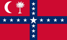
During the Antebellum years leading up to the Civil War, the island's owners, the Kirk family, continued to prosper because of cotton even as they became active in southern rebellion causes that led to Secession from the Union.
[18] In 1861 the Port Royal invasion by Union forces led to plundering and routine foraging for food and livestock throughout the Lowcountry, including Callawassie Island.
General Burns was an absentee landlord assigning multiple leasing rights for the island's acreage to local area farmers over the next fifty years.
Life on the island was simple, but far from easy, often resulting in death at an early age caused by: polluted waters, epidemics of infectious diseases, and occasional natural disasters including storms, drought, and earthquakes.
[23] After the Great Storm, Callawassie Island farmer Willie Pinckney secured loans to rebuild farms, maintain livestock, and grow crops.
One such protest involved a connector road routing that was planned directly across the island to support highway infrastructure for a large petrochemical plant to be built at Victoria Bluff on the Colleton River.
The project was defeated by widely voiced protests, which reached the White House, demanding protection for and the preservation of local river and harbor water quality and wildlife.
He was the son of Major James Hamilton, an aide to General George Washington in the American Revolutionary War, and grandnephew of Thomas Lynch, Jr., a signatory of the Declaration of Independence.
Through marriage, James Hamilton, Jr., was nephew-in-law of South Carolina's largest, and most prosperous rice planter, Nathaniel Heyward, and stepson-in-law of Savannah River investor Nicholas Cruger.
The long tabby wall on the north side of the boiling house collapsed outward and retained enough integrity to enable theoretical reconstruction of the original layout of windows.
Tabby, referred to as "poor man's masonry", is a building substance created by mixing locally available materials, such as oyster shells, with equal parts, water, sand, and lime.
Despite Hamilton's entrepreneurial hopes, and Spalding's professional expertise, the growing conditions in the Low country of South Carolina were not ideally suited for the successful cultivation of sugar cane, which prefers a year-round temperature of 75 degrees Fahrenheit with at least 60 inches of rainfall.
[36] The spartina cord grass provides essential nutrients, making the tidal marshes a breeding ground or nursery for countless species of mammals, birds, fish, and invertebrates.
[40] The characteristic maritime-like forest occurring on the perimeter of Callawassie Island is composed of live oak and salt-tolerant species such as loblolly pine and palmetto.
[41] Many large live oaks are scattered throughout the island, but it is believed that many were harvested for shipbuilding until the advent of ironclads during the Civil War, when wood was replaced by metal.
[note 1] This magnolia community appears to be a virgin or near-virgin forest: an area exhibiting this amount of maturity requires several hundreds of years to reach its climax.
Because this midden is composed of four feet of shell materials, the land was totally unsuitable for cultivation and appears to have been left undisturbed by early settlers as well as recent occupants of the island.
[44] A pine-mixed hardwood forest covers more acreage on the island than any other type and is generally the result of intermittent succession from areas used for agriculture or from the cutting of pine.
The Architectural Review Committee (ARC) has strict guidelines for the development and maintenance of landscape plans consistent with the long-term preservation of the island's natural environment.
In addition, a land management plan provides guidelines and standards for the maintenance of the island's common properties and open spaces, including the golf course.
A walk through each park provides the visitor with a different experience because of the distinctive flora and views of the tidal rivers and salt marshes that surround the island.
Sugar Mill Park sits on a low bluff on the northwestern side of Callawassie Island, overlooking the salt marsh and a branch of the Chechessee River.
A path flanked by live oaks draped with Spanish moss runs from Sugar Mill Drive to a community dock that provides access to the river.
Because of the tall pine canopy, sunlight is able to penetrate to encourage the growth of understory flora such as oaks, sweet gum trees, hickories, sassafras, yaupon hollies, and wax myrtles.
Nectar plants in the garden include butterfly bushes, shasta daisies, zinnias, Joe Pye weed, yarrows, lantanas, sages, abelias, bee balm, and a vitex tree.