Caludon Castle
Caludon Castle is a Scheduled Ancient Monument and Grade I listed building in Coventry, in the West Midlands of England.
The estate was divided up and much of it sold in 1815, and remained in the hands of multiple private owners until most of the land was purchased by the Coventry Corporation after the First World War and used for housing developments.
The remains of the Caludon estate are today located in Wyken, a suburban area to the east of Coventry city centre.
The estate was historically a detached part of St. Michael's parish, but was transferred to Wyken in 1884, which in turn was absorbed into the City of Coventry in 1928.
Several farm buildings, associated with the castle, lay just outside the moat, along with a bowling green, gardens, and a three-acre field known as "the pool".
When the property was converted to a mansion, circa 1580, many outbuildings were recorded as still standing, including a porter's lodge and brewing house.
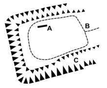
[2] A survey conducted in 2008 found the foundations of a rectangular building, oriented north-north-west, thought to be the remains of a large hall, 33 x 13 metres (108 x 43 feet).
To the north of the hall the survey found magnetic anomalies representing a complex of living buildings styled as a manor house.
[4] The Caludon estate expanded slightly into Wyken, to the north, in 1279 when Nicholas de Segrave purchased a carucate and mill.
[1] The house was likely rebuilt as a castle in 1305, when John de Segrave, 2nd Baron Segrave, Nicholas' son, was granted a licence by King Edward I of England to crenellate the property (decorating a parapet with rectangular gaps in the wall through which archers could fire; largely a status symbol by that time) and to build a moat and wall.
The house was badly damaged in 1662 when King Charles II took revenge on Coventry for its heavily parliamentarian sympathies in the English Civil War.
[1] The castle is now a ruin, and all that remains above ground is a large grey sandstone wall, which has been the only remnant of any building on the site since at least the early 18th century.