Camiguin
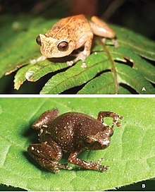
It is home to lush interior forest reserves, collectively known as the Mount Hibok-Hibok Protected Landscape, which has been declared by all Southeast Asian nations as an ASEAN Heritage Park.
The three sites were declared for “possessing outstanding historical, cultural, artistic and/or scientific value which is highly significant and important to the country and nation.” Additionally, the island province has numerous Important Cultural Treasures, such as the Old Mambajao Fountain - situated in the town's rotonda, the Old Mambajao Municipal Building, the façade of the Santo Rosario Church in Sagay, and 14 heritage and ancestral houses.
There have been moves to establish a dossier nomination for the province to be included in the UNESCO World Heritage List.
[7][8]: 55 [9] The name Camiguin is derived from the native word Kamagong, a species of ebony tree that thrives near Lake Mainit in the province of Surigao del Norte, in the mainland Mindanao, where the earlier inhabitants of the islands, the Manobos, originated.
The island of Camiguin is believed to have been first inhabited by the Manobo people of Surigao del Norte, as evidenced by the distinctly connected language between the two groups.
The island was used as a trading stop point by various merchants and traders from the Rajahnate of Butuan, the Kedatuan of Dapitan, the ancient people of the Anda peninsula, and possibly the Rajahnate of Cebu and the animist Maranao of Lanao before the Islamization of the Lanao provinces.
Old Spanish documents indicate that the explorers Ferdinand Magellan and Miguel Lopez de Legaspi landed in Camiguin in 1521 and 1565, respectively.
The name was coined from the Visayan terms mamahaw, meaning to usher breakfast, and bajao, which is leftover boiled rice.
[11] In 1901, in the middle of the Philippine–American War, American soldiers landed in Camiguin to assume political control over the island.
A group of Camiguinons, armed with bolos and spears, led by Valero Camaro, fought them in a short battle in Catarman.
However, a small detail with regards to the colonial resistance in Cagayan, Misamis indicates that Camiguinons supported in a clandestine way the revolutionary activities of the Cagayanons against the new colonizers.
[12] In the same year, Camiguin became part of the newly established province of Misamis by virtue of Act No.
On September 9, 1904, the first public water system, known as Las Aguas Potables de Mambajao, spearheaded by an admired civic leader by the name of Placido Reyes and co-operated by townspeople, was inaugurated.
[15] On June 18, 1942, the Japanese Imperial Army landed in Camiguin and set up a government in Mambajao.
[11] The beginning months of the 1970s had marked a period of turmoil and change in the Philippines, with many implications for Camiguin.
[18][19] During his bid to be the first Philippine president to be re-elected for a second term, Ferdinand Marcos launched an unprecedented number of foreign debt-funded public works projects.
[22][23][24][25] : "43" In 1972, one year before the expected end of his last constitutionally allowed term as president in 1973, Ferdinand Marcos placed the Philippines under Martial Law.
[26] This allowed Marcos to remain in power for fourteen more years, during which Camiguin went through many social and economic ups and downs.
Other languages spoken varyingly include Boholano dialect of Cebuano, Hiligaynon, Ilocano, Kapampangan and Waray.
Poverty incidence of Camiguin Source: Philippine Statistics Authority[36][37][38][39][40][41][42][43] The economy is based upon fishing and farming, with copra providing the greatest income contribution.
The province has a total number of 68 day care centers managed by the Department of Social Welfare and Development (DSWD) and 56 public and private elementary schools.
[44] Each year in the third week of October, a festival is held to celebrate the Lanzones (locally called bwahan/buahan),[what language is this?]
Several centuries-old Spanish Colonial and 20th century churches are found in various parts of the island.
On February 16, 1871, earthquakes began to be felt on the island, which increased in severity until April 30, when a volcanic fissure opened up 400 yards (370 m) southwest of the village of Catarman, northwest of Hibok-Hibok Volcano.
Vulcan was born and continued erupting and pouring lava into the sea, at the same time gaining in height and width.
In 1875, the Challenger expedition visited the area and described the mountain as a dome, 1,950 ft (590 m) in height, without any crater, but still smoking and incandescent at the top.
All that remains today of Catarman Viejo are the ruins of the ancient Spanish church, a convent, and a bell tower.