Cape Eluanbi
These characters literally mean "Goose Bell Nose", but actually transcribe the local Hokkien pronunciation Gô-lôan, used as a transliteration of the Paiwan goran ("sail").
It is also sometimes known as Eluan Pi[4] or Oluanpi;[3] as Gaw-loan-phi,[5] Ngoluanpi, or Goa-loan-pi from its Hokkien pronunciation; or as South Cape from its position.
The area's geologic formation is known as the Eluanbi Beds (層, céng), a Pleistocene stratum of yellow and brown sand, gravel, and clay.
[10] Informally, Eluanbi may also be considered part of the Luzon Strait and Bashi Channel between the territory of Taiwan and the Philippines.
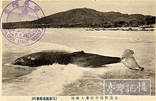
The cape's strong currents and nearby Qixingyan reefs produced numerous shipwrecks, provoking international incidents in the case of the Rover in 1867 and a Ryukyu convoy in 1871 that led to American and Japanese invasions of the island.
[13] Shen reformed the civil and military administrations on Taiwan, launched assaults against restive tribes, and began a public works program on the southern coast including a lighthouse at Eluanbi.
[14][15] Construction of the lighthouse fell under the purview of the British diplomat Robert Hart,[13] who served as inspector general of the Imperial Maritime Customs Service.
[13] This gesture did not keep the Paiwan and other tribes from raids and assaults against the Chinese construction projects, which necessitated garrisoning and fortifying Eluanbi.
[16] The accidental exposure of several stone coffins near the lighthouse in 1956 prompted investigation of the area by the archaeologists Sung Wen-tung and Lin Chao-chi that year and again in 1966.
During the construction of paths and walkways prior to its opening, further prehistoric relics were found in 1981 and excavated over the next two years by teams under Li Kuang-chou.