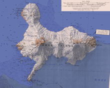
Cape Royds
When Shackleton went into McMurdo Sound in 1908, having failed to land on King Edward VII Land, he decided to build a hut at Cape Royds, a small promontory twenty-three miles north of Hut Point where Scott had stayed during the Discovery Expedition.
The largest of several small frozen lakes near Cape Royds, lying 0.5 nautical miles (0.93 km; 0.58 mi) north-northeast of Flagstaff Point.
A small lake at Cape Royds, lying close to the coast, about 0.75 nautical miles (1.39 km; 0.86 mi) north of Flagstaff Point.
Named by British Antarctic Expedition, 1907-09, who built their winter hut adjacent to this lake, because they had their ponies tethered nearby.
A small elongate lake 0.5 nautical miles (0.93 km; 0.58 mi) north of Cape Barne.
A low headland, 34 metres (112 ft) high, that marks the north entrance point to Horseshoe Bay in west Ross Island.
Named by New Zealand Geographic Board (NZGB) after Technical Services Officer Garth Edwin Varcoe, who worked in the NZ Antarctic Program over a period of 15 years until his accidental death in a helicopter crash near this headland in October 1992.
Named by New Zealand Geographic Board (NZGB) after Terry Newport, a carpenter in the NZ Antarctic Program, who perished in a helicopter crash near this point in October 1992.
A beach formed of black volcanic sand, about 0.5 nautical miles (0.93 km; 0.58 mi) northward of Flagstaff Point.
The descriptive name was given by members of the British Antarctic Expedition, 1907-09, who found the beach within safe walking distance of their base hut near Flagstaff Point.
A small summit about 455 metres (1,493 ft) high, that is locally conspicuous, located 3.8 nautical miles (7.0 km; 4.4 mi) east of Cape Royds and 3 nautical miles (5.6 km; 3.5 mi) northeast of Cape Barne on Ross Island.
Charted and named by the British Antarctic Expedition under Shackleton, 1907-09, which established its winter headquarters and erected a flag near the point.
The British Antarctic Expedition, 1907-09, under Shackleton, unloaded supplies at Backdoor Bay for use at their winter headquarters on Cape Royds.
A hill, 184 metres (604 ft) high, located 1.1 nautical miles (2.0 km; 1.3 mi) northeast of Cape Barne in west Ross Island.
This article incorporates public domain material from websites or documents of the United States Geological Survey.