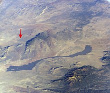
Carrizozo volcanic field
[6] At their southern end, the lava flows are about 12 miles (19 km) north of the dune fields of White Sands National Park.
[8] The Valley of Fires Recreation Area provides access to the Malpaís on its east edge, about 3 miles (4.8 km) west of Carrizozo on U.S. Route 380.
The flow covered an area of about 50 square kilometers (20 sq mi) and is partially overlapped by the younger Carrizozo Malpais.
This flow is significantly older than the Carrizozo Malpais, with an age estimated as 100,000 years, based on the degree of weathering and erosion.
[10] The lavas erupted were mildly alkaline in composition, similar to the nearby Jornada del Muerto, Hillsboro, and Black Mesa (33°44′46″N 106°52′23″W / 33.746°N 106.873°W / 33.746; -106.873) flows.