Carska Droga
The road was constructed at the turn of the 19th and 20th centuries to connect the imperial fortresses of Łomża [pl], Osowiec, and Grodno, serving as a lateral route.
However, the term "Carska Droga" is more commonly used in a narrower sense, referring to a 33-kilometer section from the Narew river bridge in Strękowa Góra to the intersection with National Road No.
This section largely traverses the Biebrza National Park or runs along its boundary, passing through embankments amid inaccessible marshes and dunes.
Nature enthusiasts typically use or narrow the term Carska Droga to refer to the 33-kilometer section[5][6][7] from the Narew river bridge in Strękowa Góra to the intersection with National Road No.
[9] From Dobarz to Strękowa Góra, for a stretch of several kilometers, the road does not run along post-glacial dunes[8] but along an embankment built through marshes – a construction feat that required significant funding,[8][9] potentially earning it the name Carska Droga.
In this broader sense, Carska Droga begins as early as Mężenin[9][10] (or even Łomża, according to some sources)[1] and runs north and northeast through Strękowa Góra, Osowiec, Goniądz, and Dąbrowa Białostocka[9] to the state border,[10] continuing to Grodno in Belarus.
[1] However, researcher Bogusław Perzyk limits it to the road linking Osowiec Fortress with Łomża, which local residents called Carska Droga.
[16] In its broader definition, Carska Droga was built at the end of the 19th century to support the Osowiec Fortress and the system of fortifications along the western border of the Russian Empire as a military lateral road.
[1] Building the road, especially the section from Dobarz to Strękowa Góra,[8][9] where it runs through marshes on an embankment,[8] posed significant challenges and incurred enormous costs.
[8][9] The construction process involved first surveying the route, removing peat, laying fascines, and covering them with gravel mixed with crushed stone using steam-powered machines.
[1][9] In September 1939, Polish soldiers marched along this road from Osowiec to the Wizna sector,[1][8][9] whose defense became one of the most heroic episodes of World War II.
[14] Carska Droga within the park's buffer zone is attractive for its natural qualities due to the absence of buildings, billboards, human presence, minimal tourist traffic and signage, and a variety of landscapes.
[14] From an environmental perspective, transforming Carska Droga into a transit route would be harmful to the Biebrza Marshes, which was blocked by nature enthusiasts.
[7] Carska Droga acts as a hydrological barrier, limiting the flow of water from the eastern to the western part of the Ławki swamp in Biebrza National Park.
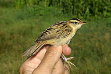
[24] It is also responsible for collisions between vehicles and various species of animals:[15] mammals (e.g., beaver, squirrel, fox, brown hare, mole), birds (e.g., common blackbird, song thrush, tawny owl, great spotted woodpecker, European nightjar), and reptiles (grass snake).
[26] A scientific report commissioned by Biebrza National Park revealed that tens of thousands of animal crossings occur annually.
[26] In November 2013, renovation began on the 33 km stretch of Carska Droga from the Mońki County border (Strękowa Góra) to National Road No.
[5] This renovation was part of the project "Providing Access to Tourism- and Economically Valuable Areas – Improving the Quality of Roads in the Polish-Belarusian Border Region", funded through the Poland-Belarus-Ukraine Cross-Border Cooperation Program 2007–2013.