Central Highlands Council
Central Highlands is classified as a rural local government area and has a population of 2,144,[2] the two largest towns are Bothwell and Hamilton.
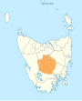
[1] Central Highlands is the least densely populated local government area of Tasmania, with only 0.3 people per square kilometre.
The municipality is classified as rural, agricultural and medium (RAM) under the Australian Classification of Local Governments.
Some of these towns were founded as support sites for workers on the hydro-electric dams scattered along the upper Derwent River.
The towns (with population as of 2006): The municipality is subdivided into eight townships:[4] • Apsley • Arthurs Lake • Bradys Lake • Brandum • Breona • Butlers Gorge • Central Plateau • Cramps Bay • Dee • Doctors Point • Elderslie • Flintstone • Florentine • Hermitage • Hollow Tree • Interlaken • Lake Sorell • Lake St Clair • Little Pine Lagoon • London Lakes • Lower Marshes • Meadowbank • Melton Mowbray • Millers Bluff • Morass Bay • Mount Field • National Park • Osterley • Pelham • Reynolds Neck • Shannon • Southwest • Steppes • Strickland • Tods Corner • Victoria Valley • Waddamana • Walls of Jerusalem • Wilburville It covers most of the mountainous centre of the state, also known as the Central Plateau which contains the Central Plateau Conservation Area including sections of the Tasmanian Wilderness World Heritage Area, as well as the Cradle Mountain-Lake St Clair National Park, and Walls of Jerusalem National Park.