Chartreuse Mountains
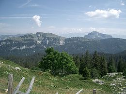
The Chartreuse Mountains (French: Massif de la Chartreuse [masif d(ə) la ʃaʁtʁøz]) are a mountain range in southeastern France, stretching from the city of Grenoble in the south to the Lac du Bourget in the north.
They are part of the French Prealps, which continue as the Bauges to the north and the Vercors to the south.
The name Chartreuse is derived from the village now known as Saint-Pierre-de-Chartreuse, earlier Catorissium, Cantourisa, Caturissium, and Chatrousse.
[1] It appears to be of Gaulish origin;[2] and is perhaps related to the name of the Caturiges tribe.
[3] The mountain range rises between Grenoble (south), Chambéry (north), Voiron and Saint-Laurent-du-Pont (west) and Grésivaudan (Isère valley, east) Summits of the Chartreuse Mountains include: Passes of the Chartreuse Mountains include : Canyons of the Chartreuse Mountains include : Plateaux of the Chartreuse Mountains include : The main caves in the Chartreuse include : The lithology is dominated by limestone, and several hundred kilometres of cave passages lie beneath the hills, including the world-famous 60 km long Dent de Crolles system.