Chiefdoms of Hispaniola
At the time of European contact in 1492, the island was divided into five chiefdoms or cacicazgos, each headed by a cacique or paramount chief.
Below him were lesser caciques presiding over villages or districts and nitaínos, an elite class in Taíno society.
In 1508, there were about 60,000 Taínos in the island of Quisqueya; by 1531 infectious disease epidemics and exploitation had resulted in a dramatic decline in population.
The first inhabitants of the island used geographic elements as references, such as major rivers, high mountains, notable valleys and plains.
The entries below relate the territory of each former cacique to the modern-day departments of Haiti and the provinces of the Dominican Republic.
The territory was also inhabited by an ethnically distinct group of natives called the Ciguayo, who were concentrated on the Samaná Peninsula.
This was noted by chronicler Bartolomé de las Casas, who wrote that in 1502 the language was on the decline and by 1527 extinct.
The fort that Christopher Columbus established on the north coast of the island, La Navidad, was destroyed by Caonabo.
Instead of being condemned to death the cacique was sent to Spain to be paraded in front of the Royal Court but died on his voyage.
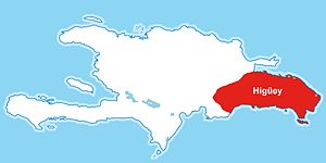
Floyd states Cotubanama was the cacique of Higüey, who was captured by Juan de Esquivel and hanged in Santo Domingo.