Christchurch Central City
Following this second earthquake, the Central City Red Zone was set up and, with a gradually shrinking area, remained inaccessible except to authorised contractors until June 2013.
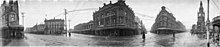
The grid pattern within the outermost one-way streets is very regular, as this is the area that was laid out in the original survey.
That year, the Canterbury Association sent out Captain Joseph Thomas, accompanied by surveyors, to select and prepare a site for settlement.
Thomas originally placed the principal town of the proposed settlement at the head of Lyttelton Harbour / Whakaraupō, but when he realised there was insufficient flat land there to meet the Canterbury Association's requirements, he relocated Christchurch to where he had previously placed a town called 'Stratford' at a point on the Avon where those coming up the river first encountered slightly higher, drier ground.
[8] Back then, the Avon River / Ōtākaro was navigable as far as 'The Bricks' just upstream of the Barbadoes Street bridge.
Thomas' plan for Christchurch (laid out by the surveyor Edward Jollie by March 1850) was the 'standard' rectangular grid of colonial settlement (adopted for ease of survey and to facilitate land sales).
Thomas did not allow Jollie to include crescents to provide variety, but the Avon River / Ōtākaro ran eccentrically across the site.
Between Salisbury, Barbadoes and St Asaph Streets and (respectively) the North, East and South Town Belts (these days called Bealey, Fitzgerald and Moorhouse Avenues) were 'town reserves', i.e. land with-held from immediate sale, which was sold off by the Provincial Government later in the 1850s to overcome cash flow problems.
Sumner in fact died too late for the names there used to be again employed in Christchurch.The original plan from 1850 shows the north-west corner of the 'town reserves' (surrounded by the Avon River / Ōtākaro, Fitzgerald and Bealey Avenues and Barbadoes Street, with an additional small rectangular area to the west of Barbadoes Street) as the cemetery for the settlement.
The Charlotte-Jane and Randolph arrived in Lyttelton Harbour on the 16th, Sir George Seymour on the 17th, and Cressy on the 27th, having set sail from England in September 1850.
Many building façades collapsed into the streets and authorities cordoned off large areas of the central city following the event.
It was located closer to the city,[20] and although lower on the moment magnitude scale than the previous earthquake, the intensity and violence of the ground shaking was measured to be IX (Violent) on the Mercalli intensity scale, and was among the strongest ever recorded globally in an urban area[21][failed verification] and in total 185 people were killed[22][23] with nationals from more than 20 countries among the victims.
[24] ChristChurch Cathedral lost its spire[25][26] and widespread damage was caused to city buildings already weakened by 4 September 2010 earthquake and its aftershocks.
[27] The Central City offered well over 450 unique retail businesses and over 130 cafes, restaurants, bars and clubs.
With over 6,000 full-time equivalent students, the Christchurch Polytechnic Institute of Technology is the major education provider in the city centre.
Cathedral Square was a popular destination and hosts attractions such as the speakers' corner made famous by the Wizard of New Zealand, Ian Brackenbury Channell, and evangelist Ray Comfort.
A primary action is to reduce the impact of motorised private vehicles and increase the comfort of pedestrians and cyclists.
The plan is based on a report prepared for the council by renowned Danish design firm Gehl Architects.
In 1981, the Christchurch City Council, in collaboration with the Cashel and High Street Businessmen's Associations, adopted a design and authorised implementation.
The streets were closed to traffic on 11 January 1982 and the Mall was opened by the former Mayor, Sir Hamish Hay, on 7 August 1982.
The road through the bridge was removed and the short stretch between Oxford Terrace and Cambridge Terrace opened as a pedestrian precinct on 25 April 1977 (Anzac Day) by Captain Charles Upham, i.e. this stretch became a pedestrian precinct some five years before the establishment of City Mall.
These areas complement The Strip, a part of Oxford Terrace that started to support outdoor dining during the day and night time entertainment in the 1990s.
[57] The southern part of the central city has traditionally been home to manufacturing, but there has been a decline in this area, with many companies either moving to commercial subdivisions, closing, or relocating overseas.
Hagley Park was named after the country estate of Lord Lyttelton, who became chairman of the Canterbury Association in March 1850.
The Gardens cover an area of 21 hectares,[79] and lie adjacent to the loop of the Avon River / Ōtākaro next to Hagley Park.
[81] Due to the grid pattern of the roads, the central city has a high number of traffic signals.
Four pairs of one-way streets are located only a few hundred metres away from Cathedral Square, making it easy to drive through the city centre.
The avenues in the north, east and south surrounding the central city are generally six-lane median divided.
Free covered bike lock-ups are located in 4 car parking building around the central city.
[86][87] The railway station used to be located on the southern boundary of the central city on Moorhouse Avenue, but has since been relocated to the suburb of Addington in 1993.