Sumner, New Zealand
Captain Thomas named the settlement for Bishop John Bird Sumner, one of the leading members of the Canterbury Association.
[5] However, J. F Menzies indicates this name is associated with a settlement on the shores of the estuary between Redcliffs and Mt Pleasant and prefers an alternative translation of "The place where sticks were rubbed together to make a fire with which to cook cockles in preparation for a journey".
[4] James Cowan, retelling Sir Maui Pomare, indicates this name applies to the estuary shallows and means "fall in the mud".
[7] Sumner was surveyed in 1849 by Edward Jollie[citation needed] for Captain Joseph Thomas, the advanced agent of the Canterbury Association.
[citation needed] The first European to carry out work in Sumner is believed to be Charles Crawford, a whaleboat owner, who transported materials from Port Cooper, now Lyttelton, under contract to build the headquarters and storeroom for Captain Thomas.
[9] On 22 February 2011, Sumner was hit by the Christchurch earthquake, which destroyed or made uninhabitable a large number of the local houses and commercial buildings.
[11] These two earthquakes caused many of Sumner's iconic cliffs to collapse, and many areas to be cordoned off with both traditional fences and shipping containers.
[10] Sumner is nestled in a coastal valley separated from the adjacent city suburbs by rugged volcanic hill ridges that end in cliffs that descend to the sea shore in places.
[citation needed] A sea wall and wide esplanade have been built along the length of the beach to prevent coastal erosion.
Shag Rock, or Rapanui, is another large volcanic outcrop at the western end of the beach and sits at the mouth of the Estuary formed by the Avon and Heathcote rivers.
[15][16] The outlet of the Avon Heathcote Estuary, at the western end of the beach, forms the Sumner bar off shore of Cave Rock.
[citation needed] The Sumner bar presents a major hazard to shipping, while the fast currents, strong rips and undertows in the area can be a danger to swimmers.
[citation needed] In December 1854, Commander Byron Drury, in HMS Pandora, surveyed the Sumner Bay, including the bar and mouth of the Avon-Heathcote Estuary for the Canterbury Provincial Council.
The earliest recorded accident crossing the Sumner Bar occurred in May 1845 when a whaleboat capsized, without loss of life.
[18] The cutter Hawk broke up crossing the Sumner Bar in rough weather at the end of June 1851 and wrecked on the beach, though the crew survived, the cargo was plundered.
The statistical area of Sumner, which includes Scarborough and Te Onepoto / Taylors Mistake, covers 2.64 km2 (1.02 sq mi).
[22] The Canterbury Association initially administered Sumner, with the valley being surveyed by Edward Jollie in 1849 and he drew up a street plan in November of that year.
[further explanation needed] By the 1940s, small town boroughs were becoming uneconomic and Sumner was merged with Christchurch city area.
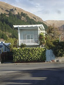
The Pascoe House in Colenso Street is a category II historic place and an early example of a two story private dwelling in the Post War Modern Domestic style of the period between 1940 and 1960.
[25] The need for a convenient route between the Port at Lyttelton and the plains settlement of Christchurch was quickly recognised by Captain Thomas, Chief Surveyor for the Canterbury Association.
The Sumner Bar is a notable navigation hazard, though it can be crossed safely in the right wind, tide and sea conditions.
But, with Sumner Bay open to the Pacific Ocean, there was no nearby safe anchorage for larger ships, short of Lyttelton Harbour, about 8 nautical miles away by sea.
In 1850, a Bridle Path was cut directly over the saddle between Lyttelton and the Heathcote Valley so that the early settlers could travel to Ferrymead by foot and pack horse, while their heavy goods still needed to be transported across the Sumner Bar by boat.
The original road line, now known as Captain Thomas' Track, was abandoned and a new way down the eastern side of the valley between Evans Pass and Sumner was subsequently found and constructed.
[27] Today, Southshore's public transportation is served by the frequent Airport (or Sheffield Crescent)—Sumner (route 3) bus service operated under the Metro brand.
Schoolmaster C. L. Wiggins, as he was almost invariably known, appears to have moved his boarding school for young gentlemen to Sumner in August 1877, according to newspaper advertisements of the time.
[40] The school taught "the usual branches of a sound English education, together with Latin and French" and provided recreations including sea bathing, cricket, and "pedestrian excursions".
[42][43] He was also a church organist, Sunday school teacher, a founding member of the Sumner Lawn Tennis Club, and involved in local body politics.