Christopher Saxton
His family subsequently moved to the hamlet of Dunningley near Tingley in the parish of Woodkirk where the Saxton name is recorded in 1567.
[2] It is most likely that John Rudd, the vicar of Dewsbury and Thornhill, a keen cartographer passed his skills to Saxton.
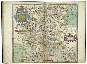
[5] Map making became increasingly common in the reign of Elizabeth I, made possible by advances in surveying technology and printing from engraved copper plates.
Lord Burghley was instrumental in ensuring that a court official, Thomas Seckford of Woodbridge, Suffolk, financed the commission.
[7] In consideration of the expenses involved, Queen Elizabeth granted him a lease on lands at Grigstone Manor in Suffolk.
Five counties, Cornwall, Essex, Hertfordshire, The Suffolk and Norfolk maps show the division into hundreds.