Chunchucmil
Although the famous explorer and author John Lloyd Stephens traveled within a few kilometers of Chunchucmil during his historic journey across the Yucatán Peninsula (he even met with the owner of the nearby haciendas),[1] the archaeological site went relatively unnoticed by Maya scholars for more than a century because virtually no monuments (stelae) or other grand sculptures have been found there.
The lack of royal monuments, combined with other archaeological data, may indicate that Chunchucmil was not a city ruled by a single divine king, as most other Maya polities.
The site of Chunchucmil is located on a narrow band of semi-arid terrain that parallels portions of the western and northern coastlines in Yucatán and Campeche.
[5][6] However, the ancient city was situated at the edge of this semi-arid ecological zone, exactly where the dry Yucatecan plains dip and fracture into vast wetlands (see map).
Immediately to the west of Chunchucmil are found the seasonally inundated savannas, fresh water petenes (or ojos de agua), and eventually the brackish mangrove estuary where the Yucatán aquifer empties into the Gulf of Mexico near the ancient Maya coastal site of Canbalam.
It is likely that ancient Chunchucmil was purposefully situated to take advantage of multiple ecological zones, including coastal resources such as the salt-beds of the Celestún peninsula, and to increase accessibility to the vigorous circum-peninsular canoe trade route of Pre-Columbian times, using Canbalam as its port of entry.
A few early colonial homesteads have been found, but the region was largely abandoned between the Maya Postclassic period and the beginnings of the cattle ranches and henequen haciendas of historic and modern times.
With the temple pyramids and central platforms acting as loci of lineage-based ritual, quadrangle groups likely housed the upper-echelon elites of ancient Chunchucmil that may have been active in the socio-political, ideological and economic administration of the city.
[11] Of particular importance is the fact that each major quadrangle group is connected to the others through a network of sacbeob (stone causeways), suggesting an unknown degree of connectedness between the residing lineages and (potentially) cooperation or competition in ruling Chunchucmil.
If this was indeed the case, Chunchucmil's political structure may have been roughly analogous to that suggested for the later Maya capital of Chichen Itza, referred to as a "multepal" system and characterized as rulership through council.
Unlike at the vast majority of Maya sites, Chunchucmil's albarrada groups contain clear boundaries between residential house lots[15] and, as of result of this, researchers are better able to study such issues as settlement patterns, occupational density, population estimates, lineage structure, and social organization.
The space between adjacent albarradas form avenues or paths for foot traffic (called callejuelas, see photo) that radiate outward from the site center and into Chunchucmil's dense residential zone.
Such rock alignments, called andadores by Maya archaeologists, would have provided sure footing through the wetlands, like stepping stones, leading travelers to various towns and resources in Chunchucmil's hinterland.
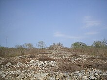
[19] One of the first features of Chunchucmil to gain widespread attention was a stone wall, visible in aerial photos taken by the Atlas project,[20] that roughly encircles 350,000 square metres of the site center (including most of the major Quadrangle Groups).
Based upon the law of superposition (an archaeological concept borrowed from the field of geology), this meant that the large barricade was likely the last feature to be built at the site.
Given this data, it has been hypothesized that the barricade was constructed rapidly at the end of Chunchucmil's history, possibly to protect the remaining inhabitants from an invasion that arrived before the wall could be completed,[22] leading to the ultimate demise of the ancient city.
Lithic analyses have determined that the majority of the blades at Chunchucmil were likely imported in finished form, as suggested by the general scarcity of polyhedral cores, production debitage, rejuvenation artifacts, and manufacturing errors at the site.
[25] Geochemical soil tests combined with careful excavations of an open area in the site center have revealed a possible market for distributing comestibles and other goods.