Cliffe Fort
Its location on marshy ground caused problems from the start and necessitated changes to its design after the structure begin to crack and subside during construction.
It is not accessible to the public and is in a poor and slowly deteriorating condition which has led it to be listed as an "at risk" heritage asset.
A new generation of increasingly accurate and powerful guns had been developed (of the Rifled Muzzle Loader (RML) and Rifled Breech Loader (RBL) types), mounted on fast-moving, manoeuvrable steam-powered ironclad warships such as the French La Gloire and the British HMS Warrior.
However, as the American Civil War was soon to show, it was quite possible for the warships of the day to run past forts and attack up coastal rivers.
[1] The government's response was to appoint a Royal Commission on the Defence of the United Kingdom, which published a far-reaching report in 1860.
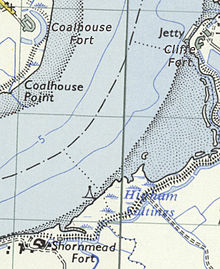
[4] The fort and its counterparts at Coalhouse Point and Shornmead were designed, except for their ironwork, by Captain Siborne of the Royal Engineers.
The part-built fort began subsiding and cracking in 1865, causing the abandonment of plans to mount guns on the roof.
The Chief Royal Engineer wrote in August 1864 after visiting the site: "The officers' quarters at Cliffe are a mere hut, an abominable stinking place in summer, very cold and wet in winter.
It stands by the side of a foul ditch which cannot be cleaned, for the mere disturbing of its contents would endanger the health of the officers.
[8] Some time after 1887, a launching station for the Brennan torpedo—a weapon which has been described as "the world's first practical guided missile"[9][10]—was added to the fort.
The fort was disarmed in 1927, but during World War II, two of the positions on the roof were altered to accommodate two 4-inch anti-aircraft guns.
[8] It is not open to the public and is fenced off,[13] though its exterior is accessible via the Saxon Shore Way coastal path, which runs in front of it.
[12] The exterior is overgrown, partly flooded and surrounded by piles of sand from the neighbouring aggregates works,[15] though it is structurally sound.