Shornemead Fort
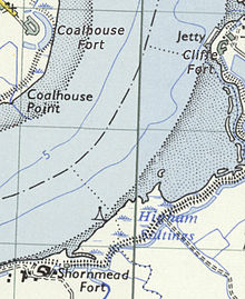
Constructed during a period of tension with France, it stands on the south bank of the river at a point where the Thames curves sharply north and west, giving the fort long views up and downriver in both directions.
It was the third fort constructed on the site since the 18th century, but its location on marshy ground led to major problems with subsidence.
The barracks and administrative buildings have been completely destroyed and only the front of the casemates survives along with the magazines underneath, though the latter are now flooded and inaccessible.
A barracks was constructed on the remaining two (landward) sides, along with bomb-proof magazines and defensive caponiers to flank the fort's ditch.
A new generation of increasingly accurate and powerful guns had been developed (of the Rifled Muzzle Loader (RML) and Rifled Breech Loader (RBL) types), mounted on fast-moving, manoeuvrable steam-powered ironclad warships such as the French La Gloire and the British HMS Warrior.
Britain's coastal defences had not been substantially upgraded since the Napoleonic Wars and the country's existing fortifications were largely obsolete.
As the American Civil War soon showed, it was quite possible for the warships of the day to run past forts and attack up coastal rivers.
[5] The government's response was to appoint a Royal Commission on the Defence of the United Kingdom, which published a far-reaching report in 1860.
[6] It was originally intended that the forts would form part of a line of defences running all the way to Chatham, but the rest of this chain was never built.
[8] It was substantially larger than its predecessor, replacing the vulnerable open emplacements with immensely strong casemates capable of resisting direct artillery fire.
An open battery stood at the west end of the casemates, mounting three guns that pointed upriver toward Gravesend and Tilbury.
They were mounted on special garrison carriages to absorb their recoil and could be trained using traverse rails to alter their direction of fire.
Aerial photographs from the time show the battery, fort, associated concrete pillboxes and searchlights surrounded by dense tangles of barbed wire.
[9] The fort was abandoned after the end of World War II and was demolished in the 1960s by the Army Demolition School of the Royal Engineers as part of a training exercise.
The site can be visited by the public, as it is now part of the Royal Society for the Protection of Birds' Shorne Marshes Nature Reserve.