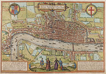
Copperplate map of London
The Copperplate map may have been engraved by mapmakers from the Low Countries, an important centre of surveying and printing at the time: this is suggested by some of its inscriptions and other details.
Philip, whose realms also included the Spanish Netherlands, was known as a keen collector of town and city plans, and may have commissioned or patronised the Copperplate map.
The reverse of the plate had been used for a painting of the Tower of Babel, dated to c. 1600 and attributed to Marten van Valckenborch or a member of his circle.
Like the first plate, the reverse had been used for a painting of the Tower of Babel, in this case dated to c. 1630 but again attributed to a member of the circle of Marten van Valckenborch.
[3] Key points include the following: What is thought to be the Copperplate map is mentioned in a letter from the cartographer Nicholas Reynolds to Abraham Ortelius, dated 1562–3.