British Columbia Highway 5
The pass is named Kwʼikwʼiya꞉la in the Halq̓eméylem language used by the Stó꞉lō, which means "stingy container" and refers specifically to a fishing rock near the mouth of what is now known as the Coquihalla River.
Exit numbers on the Coquihalla are a continuation of those on Highway 1 west of Hope, as it is an extension of the freeway that starts in Horseshoe Bay.
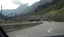
35 km (22 mi) north of Othello, after passing through five interchanges, Highway 5 reaches the landmark Great Bear snow shed.
After exiting Merritt, the highway climbs up a long, steep hill toward another high point, the Surrey Lake Summit.
A diamond interchange at Exit 336 provides an important turnoff to Logan Lake on Highway 97D and Lac le Jeune.
This stretch of road, which carries 97 South and 5 North on the same lanes (and vice versa), is the only wrong-way concurrency in British Columbia.
Highway 5 re-enters the city at the Rayleigh community, where it passes two busy at-grade, but not signalized intersections; traffic volumes steadily decrease as it gets farther from the core area of Kamloops.
Traffic volumes thin out at that exit, and shortly afterward Highway 5 narrows to a two-lane undivided road.
Highway 5 proceeds northeast for another 107 km (66 mi), passing Vavenby and Avola en route to the community of Blue River, a popular heliskiing location.
Next it passes Tête Jaune Cache and crosses the Fraser River, after which it immediately meets Highway 16 in a partial interchange, marking its northern terminus.
[7][8] To ensure the project was completed on time, more than 10,000 workers were needed, and more than 1,000 pieces of heavy equipment worked non-stop every day during the summer of 1985.
[7] On May 16, 1986, Phase 1 was officially opened, and Highway 5 was re-routed between Hope and Merritt; its construction required 31 bridges and underpasses and over 3.7 million tonnes (4,100,000 short tons) of gravel.
[7] The three phases have been credited with transforming Merritt into an important transportation hub between the coast and interior, as well as significant growth in both Kamloops and the Okanagan due to improved accessibility.
[12] In response to strong opposition from the public and numerous businesses in the Interior of British Columbia, the provincial government shelved the move three months later.
[18] In June 2016, the province implemented a variable speed limit corridor around the Coquihalla Summit Park to increase safety during adverse conditions.
[22] DriveBC provides up-to-date reports on Coquihalla Highway conditions, including live webcams in several locations.
[24]On November 14, 2021, a major storm in southern British Columbia damaged sections of the Coquihalla Highway and other routes in the area.
[citation needed] After the washouts, Canadian Forces Cormorant helicopters evacuated stranded motorists on the highway.