Counties (Detached Parts) Act 1844
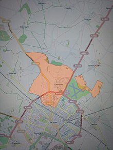
Two parishes mentioned in the Counties (Detached Parts) Act 1844 had been subject to this procedure: Stratton Audley in Buckinghamshire and Oxfordshire (1770),[3] and Farndish in Northamptonshire and Bedfordshire (1800).
The Liberty of St Martin's Le Grand was situated in the City of London,[8] but was part of the borough of Westminster[9] and an exclave of Middlesex.
However, the few electors left in residence were still under Westminster and this illustrated the need for multiple parliamentary interventions to deal with the issues thrown up by exclaves.
[11] The systematic involvement of the House of Commons began in February 1825, when Charles Fyshe Palmer, Member of Parliament for Reading, moved a private member's bill entitled "County Transfer of Land Bill": To empower magistrates at quarter sessions to effect Exchanges between counties of insulated parcels of Land, for the more convenient administration of justice.
However, the process resulted in the publication in May 1825 of the "County Boundary: Returns from Clerks of the Peace of Insulated Parcels of Land".
[13] The process was not altogether satisfactory, witness the return of the Hertfordshire clerk: There is much difficulty in answering the inquiries with any certainty.
[15]Actually, Studham was equally divided between the two counties and the exclave that the clerk was referring to belonged to Whipsnade.
Previously each county, including its exclaves (but excluding its boroughs) elected two knights of the shire to the House of Commons.
The largest changes were to County Durham, which lost substantial territory to Northumberland, as well as a single parish to Yorkshire.
[14] The 1832 schedule listed them as exclaves of Huntingdonshire in Northamptonshire (back to front),[24] and the 1844 Act ignored them.The wording of the Act was effective in dealing with exclaves wholly or mostly surrounded by a single other county, but not for examples with approximately equal borders of two other counties.
Some salients were abolished, and one example of such a transfer (Oxenwood in Berkshire, surrounded mostly by Wiltshire) was challenged as erroneous and cancelled.
[25] Two boundary disputes, between Cornwall and Devon and Derbyshire and Cheshire, were resolved using the Act although no exclaves or salients were involved.
Finally, there were a few strange cases involving divided parishes which were either errors or had ulterior motives, such as Studley in Buckinghamshire transferred to Oxfordshire.
Many of the surviving outlying parts changed their administration in the 1890s following the passing of the Local Government Act 1894, which made the legal process easier.


