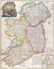
County Clare
Clare is north-west of the River Shannon covering a total area of 3,450 square kilometres (1,330 sq mi).
The patella of a bear, which was subject to butchering close to the time of death, was found in the Alice and Gwendoline Cave, near Edenvale House, Clarecastle.
[10] Ptolemy created a map of Ireland in his Geographia with information dating from 100 AD; it is the oldest written account of the island that includes geographical features.
[12] Historians have found the tribes on the west of Ireland the most difficult to identify with known peoples; however, historians William Camden and Charles O'Conor speculated a possible connection between the Gangani and the Concani,[13][14][15] one of the eleven tribes in the confederacy of the Cantabri in the northern part of the Iberian Peninsula.
[16] During the Early Middle Ages, the area was part of the Kingdom of Connacht ruled by the Uí Fiachrach Aidhne.
[31][needs update] In addition, Clare had a large diaspora due to vast emigration during the 19th century.
There are millions of people around the world who can trace their family background to Clare; such descendants are found mostly in North America, Great Britain, Australia, South Africa, Argentina and New Zealand.
Some of the most common examples are O'Brien, O'Gorman, O'Dea, McMahon, McInerney, McNamara, McGarry, Moloney, O'Grady, Hogan, Considine, Griffey/Griffin and Lynch.
[37] In the present day, the Catholic Church still commands a large majority, with 88% of the populace declaring themselves as followers of the religion.
A small portion of the north-western part of Clare falls under the Diocese of Galway, Kilmacduagh and Kilfenora.
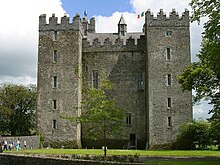
[39] As part of the local council's architectural conservation project, around eighty Christian churches have been designated as protected structures.
The most prominent of these areas with native Irish language speakers were west of Ennis in Kilmihil, Kilrush, Doonbeg, Doolin, Ennistimon, Carrigaholt, Lisdoonvarna and Ballyvaughan.
[43] By the time of the second Coimisiún na Gaeltachta in 1956, the decline in the number of Gaelic speakers had been such that West Clare was removed from the list.
Close geographic proximity to the Aran Islands (which were once part of Thomond) and local trade with fishermen from there meant that the language was used by residents of Fanore, Murroogh, Doolin and Quilty more than in other places.
The last native Clare Irish speaker, the seanchaí Paddy Pháraic Mhíchíl Ó Sionáin (Shannon) of Fisherstreet, Doolin, died in the early 1990s.
In the early 21st century, the pressure group Coiste Forbartha Gaeltachta Chontae an Chláir sought to restore the official status of West Clare as a Gaeltacht area.
Ennis in County Clare is also the birthplace of Grammy-nominated singer Maura O'Connell whose grandmother started a fish market in the town.
The other is "My Heart's Tonight in Ireland" (recorded on his solo album Rain on the Roof in 1996, and again on Changing Trains in 2005), in which he mentions several towns and villages in County Clare: Milltown Malbay, Scariff, Kilrush, Sixmilebridge, Kilkishen, Lahinch, Ennistymon, Liscannor and Kilkee, and also makes two references to the music of Willie Clancy: In the town of Scarriff the sun was shining in the sky When Willie Clancy played his pipes and the tears welled in my eyes Many years have passed and gone since the time we had there But my heart's tonight in Ireland in the sweet County Clare.
... Lahinch and Ennistymon, Liscannor and Kilkee But best of all was Milltown when the music flowed so free Willie Clancy and the County Clare I'm ever in your debt For the sights and sounds of yesterday are shining memories yet.
Milltown Malbay is home to Oidhreacht an Chlair, an institute for higher education in all aspects of Irish tradition, history and literature.
Irish rugby internationals from Clare include Keith Wood, Anthony Foley & Marcus Horan.
[47] These two roads are part of the wider Western and Southern Corridor connecting many of the major settlements right across the island in these areas.
There are also some significant national secondary roads—across the coast, stretching from Ballyvaughan, through Ennistymon and Kilkee, before arriving at Kilrush is the N67.
[citation needed] By route of Limerick the trains run from Ennis to Dublin and it generally takes 3 hours to complete the journey.
Much of it was dug up and dismantled by the Irish government from the 1950s to the 1970s after being deemed uneconomic; however, there remains local advocacy groups who wish to conserve and restore parts of it.
[54] Ryanair is the main airline handling flights with Great Britain and Continental European countries such as Spain, France and Germany as the primary destinations.
[55] Much traffic from the United States is received, which Aer Lingus mostly handles; it is sometimes used as a military stopover which has caused some controversy in the country,[56] but nonetheless has generated significant revenue for the airport.