Coventry, Rhode Island
According to the United States Census Bureau, the town has a total area of 62.3 sq mi (161 km2).
Coventry was first settled by English colonists in the early 18th century, when the town was part of Warwick.
However, by 1741, enough farmers (about 100 families) had settled in the area that they petitioned the General Assembly of Rhode Island to create their own town.
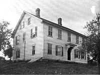
Nathanael Greene, a resident of Coventry, rose through the ranks to become a leading general of the American army.
Over the next century, the eastern end of town became very industrialized, with manufacturing centers being located in Anthony, Washington, Quidnick, and Harris villages.
Many of the old factories still stand in the town, and the village centers (in particular, Anthony and Quidnick) remain mostly intact.
The demographics of the town changed, as industrial jobs at these new mill villages attracted French Canadian and Irish immigrants.
By the end of the 19th century, almost one fourth of the population was born outside the US, and French was the primary language for many of the people in the eastern part of Coventry.
The 860-acre (3.5 km2) George B. Parker woodland, owned by the Audubon Society of Rhode Island, offers several hiking trails.
The town has been investing in the Coventry Greenway, a pedestrian and bicycle path built on the old New York, New Haven and Hartford Railroad right-of-way and part of the East Coast Greenway, a trail running from Maine to Florida.
The greenway has recently undergone a massive renovation and has reopened to the public as a walking, cycling, and horse trail.
The village of Greene and the Rice City and Hopkins Hollow parts of town have remained unchanged since the 19th century.
At the federal level, Coventry is included in Rhode Island's 2nd congressional district and is currently represented by Democrat Seth M. Magaziner.