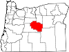
Crook County, Oregon
[3] Crook County was established on October 9, 1882, by an act of the Oregon State Legislature.
[4] The county was named after General George Crook, a veteran of various battles against the indigenous peoples of Eastern Oregon in the middle of the 19th century.
The first effort to develop routes into the area was in 1862 when a supply train with cattle crossed the Scott Trail.
From the start cattle ranching has been one of the primary industries of the county, with huge herds grazing the countryside from the 1880s.
[4] Logging in the Ochoco Mountains and the timber mills that accompanied also greatly contributed to the economic and population growth of the county.
[6] The largest body of water in Crook County is the Prineville Reservoir.
This formation is an outcropping of Devonian limestone created from a larger reef when most of Oregon was covered by water.
[16] Forest products, agriculture, livestock raising and recreation/tourism services constitute Crook County's total economy.
Agriculture is supported by the development of irrigation districts, which permits the raising of hay, grain, mint, potatoes, and seed.
Range and forest lands allow grazing for a sizable livestock industry.
The Ochoco National Forest's stand of ponderosa pine is the main source of lumber.
Thousands of hunters, fishers, boaters, sightseers and rockhounds are annual visitors to its streams, reservoirs and the Ochoco Mountains.
The Prineville Chamber of Commerce provides access to over 1,000 acres (4.0 km2) of mining claims to rockhounds, who can dig for free agates, limb casts, jasper and thundereggs.