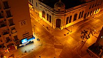
Culiacán
[3] An ancient Indigenous settlement called Huey Colhuacan dates back to Tecpatl, corresponding to the year 628 CE.
Upon their arrival in the 16th century, the Spanish found the existence of farmhouses organized in indigenous nations by the tribe of the Tahues, which brought together a group of people of the same origin and language who had a common tradition.
In 1861, during the conservative government of the French Intervention, prefectures were installed, and the Municipalities Law was decreed that divided the Districts into City Councils.
Within its original limits was the current Municipality of Navolato, which was segregated from Culiacán on 27 August 1982, depriving the city of 2,285 square kilometres (882 sq mi) of valley agriculture.
Sometime later, the State Congress approved the extension of the capital city's name, giving it its current official name of Culiacán de Rosales.
Beginning in the late 1950s, Culiacán became the birthplace of an incipient underground economy based on illicit drugs exported to the United States.
The completion of the Pan-American Highway and the regional airport in the 1960s accelerated the expansion of workable distribution infrastructure for the enterprising few families that would later come to dominate the international drug cartels along Mexico's Pacific Northwest.
[4] On 17 October 2019, after an ultimately unsuccessful attempt to arrest one of the cartel leaders, widespread gunfights broke out across the city, leading to multiple deaths, in what has been called the "Battle of Culiacán".
This glyph alludes to Coltzin, "the crooked god", an authentic figure of Nahuatl mythology, who gave its name to the Nahuatlaca-Colhua tribe and, in turn, to the town of its residence, Colhuacán or Teocolhuacán.
In the upper part of the shield, there is a hill with a germinating seed and the figure of a golden sun, alluding both to the tropical climate of this region and to the fundamentally agricultural effort of its inhabitants.
For its internal regime, the municipality is subdivided into 17 receiverships, which in turn are divided into police stations, the 17 receiverships of the municipality are: El Salado, Higueras de Abuya, Baila, Aguaruto, Emiliano Zapata, Adolfo López Mateos (El Tamarindo), Jesús María, Las Tapias, Quilá, Sanalona, San Lorenzo, Tacuichamona, Tepuche, Imala, Costa Rica, Culiacáncito and Eldorado.
[8] The coastal plain lies to the West and is crossed by four regional rivers: the Humaya, Tamazula, Culiacán and San Lorenzo.
The Humaya has its origin in the State of Durango, entering Sinaloa through Badiraguato; its waters are controlled by the Licenciado Adolfo López Mateos dam.
The Tamazula River arises in the Sierra Madre Occidental near the Topia Valley; its waters are controlled by the Sanalona dam.
The San Lorenzo is borne from the Sierra Madre Occidental within the State of Durango, enters Sinaloa through Cosalá and empties into the Gulf of California.
The city ranks 20th in number of foreign population, which amounts to 6,693 inhabitants, which represent almost 1% of the total population; Among the main nationalities are Americans, Canadians, Spanish, Italians, Greeks, Argentines, Cubans, Colombians, Brazilians, Chinese, Japanese, Russians, Ukrainians, Venezuelans, Dominicans, Germans, among others.
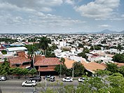
In general, cement roofs, walls, and floors are used for the construction of the house, although homes or buildings do not cease to exist, most of them have sheet roofs and earth floors, this occurs mainly in the area peripheral to the south of the city, where the humble settlements of new inhabitants who arrive with the hope of obtaining a better quality of life proliferate.
From the '70s onwards, there was a process of depopulation of the area due to the high costs of rents, the bustle of the main streets and avenues, and the priority of having more commercial spaces, but in recent years there has been a process of repopulation of the same with the construction of apartments in the periphery of the Center and a project of urban reorganization in which it is intended to have a higher population density.
Las Colonias, which are the first settlements that populated the perimeter around the original urban area by people from different social strata to have a largely wide space close to the Center; Among the best known and with the largest population, we find: Infonavit Humaya, Tierra Blanca, 6 January, Stase, Juntas de Humaya, Almada, Miguel Alemán, Centro Sinaloa, Morelos, Palmito, El Barrio, Aurora, etc.
Residentials are considered to be areas strategically built for people with high purchasing power, with spacious houses, and large green areas, and in most cases, they are delimited as private, and we find: Tres Ríos, Chapultepec, Los Álamos, Guadalupe, Lomas de Guadalupe, Colinas de San Miguel, Montebello, La Campiña, Las Quintas, Isla Musalá and La Primavera.
The development also took advantage of the lands adjacent to the Culiacán, Humaya, and Tamazula rivers, embellishing the banks with vegetation and a new boardwalk.
On 17 February 2014, investigators from Mexico and the United States learned that Joaquín Guzmán Loera, or El Chapo, was using underground sewage tunnels in Culiacán by constructing hatches connecting to the drainage network in the bathtubs of his city "stash houses".
Culiacán is linked to the satellite city of Navolato by a freeway that now reaches Altata on the Pacific Ocean coast.
Located to the east of the city, this area is 10 ha and is home to different ecosystems and hundreds of plant and tree species, as well as the art installation Encounters by James Turrel.
Located next to the heart of the city, forming part of the Civic Center Constitución with an extension of 13.5 hectares, it houses 1,400 animals belonging to more than 450 species, including mammals, reptiles, and birds.
This show is presented every day in an area of the 3 Ríos Project where the flagpole is located, more specifically, at the mere confluence of the Humaya and Tamazula rivers.