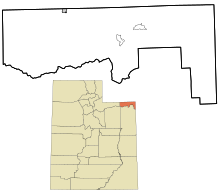
Daggett County, Utah
[2] The small community of Dutch John, located near the state line with Colorado and Wyoming, became an incorporated town in January 2016.
[3] Due to dangerous roads, mountainous terrain, and frequent bad weather preventing travel via a direct route, 19th century residents in the north portion of Uintah County had to travel 400 to 800 miles (640 to 1,290 km) on both stagecoach and rail to conduct business in Vernal, the county seat, a mere 50 miles (80 km) away.
[citation needed] The journey involved overland travel to a train station in Wyoming, to either Mack, Colorado, Price, or Salt Lake City, then a stagecoach to Vernal.
Its main geographical features are the Uinta Mountains, which comprise its southwestern portion and delineate part of its southern border, and the Green River, which has carved a deep gorge through the east-central part of the county.
The county's highest point is on a mountain crest along its south border, at 12,276 ft (3,742 m) ASL.
As of 2016, the largest self-reported ancestry groups in Daggett County, Utah, were: Daggett County is governed by three commissioners, an auditor/HR director, a recorder/treasurer, a clerk, an assessor, and a sheriff, all elected for four-year terms in partisan elections.
The few commercial establishments in Daggett County exist to service tourists and users of the Flaming Gorge National Recreation Area.
Throughout the county, there is one small general store, several gas stations, five cafes or restaurants, five inns/motels, and a few miscellaneous businesses that offer raft rentals.
Some businesses offer guided fishing trips on the Flaming Gorge Reservoir and the Green River.