Dalry, North Ayrshire
Dalry (from Scottish Gaelic: Dail Ruighe, 'the haugh at the slope'[2]) is a small settlement on the Rye Burn.
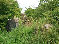
[3] Its history has signs of early inhabitants in the area; the remains of an ancient fort, made of three concentric round walls, can be found on the summit of Carwinning Hill to the North of Dalry, west of the B784 to Largs.
In 1883, excavations by John Smith of caves in the Dalry Blair estate at Cleeves Cove found evidence of prehistoric man and otter bones.
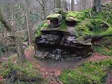
Aitnock Fort at the south-west angle of Hindog Glen, was excavated by John Smith in 1901–02, it showed a possible dun occupying the summit of a cliff which rises about 60 feet (18 m) perpendicularly from the Rye Water.
He stated in his Excavations of the forts of Castlehill, Aitnock and Coalhill, Ayrshire, that it was defended on one side by the steep drop to the Rye and by a horseshoe shaped deep ditch and stone walls.
The interior was about 30 feet (9.1 m) in diameter, the floor had been leveled, then covered with yellow clay over which a pavement of rough slabs and river pebbles had been laid.
During his excavations he found four silver Roman coins, all denarii, two of Antoninus Pius and one each of Vespasian and Hadrian, all of which came from parts of an upper black layer of occupation.
One of these "nobles or knights", Hugh de Morville, was made Lord High Constable of Scotland and given lands in Cunninghame.
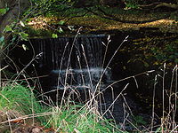
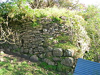
The dam still exists (2008) and can be seen on the Putyan Burn close to a pedestrian bridge that gave views of the installation to visitors.
[7] During this period, the family also owned Baidland on the north-western side of Dalry, Highlees just south of Dundonald, and the estate of Bourtreehill near Irvine.
[10] In 1614 John Lyn of that Ilk is recorded as the lord superior of the lands of 'Hileis' in the parish of Dalry and Patrick Hunter of Hunterston was his baillie.
The Lords of Lynn became extinct as a landed family in Dalry, but they were remembered in Ayrshire folklore as "a beloved aristocracy that came, lingered a while, and vanished.
She answered her accusers that she received information on prophecies or to the whereabouts of lost goods from a Thomas Reid, a former barony officer in Dalry who died at the Battle of Pinkie some 30 years before.
[18] She said she first met him while walking between her own house and the yard of Monkcastle, and after a discussion he then disappeared through a hole in a wall or dyke, apparently too small for a normal person to pass through.
Her abilities were more akin to today's current psychics, and with an understanding of medicinal herbs, she was identified in a time of witchcraft hysteria.
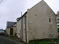
When the main parish church at the Glebe was resited at the "cross" in 1608 it created around it a "kirktoun" establishing the village of Dalry.
Various manufacturing existed in the parish relating to cotton and carpet yarn with silk and harness weaving, in which both men and women were employed.
The opening of numerous limeworks, and a number of coal pits from the 1840s, wholly changed the character of the parish of Dalry.
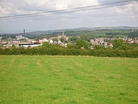
It became an increasingly industrial area peppered with mines to provide the ore and coal to fuel the blast furnaces at the various iron works.
This development of large iron works and the mining of ore and coal further increased the housing stock and population in and around the area.
Morning and evening daily stage coaches passed through Dalry on the routes between Glasgow and various coastal destinations.
These waters were utilised by the various mills in the 19th century The industries of limestone, coal and ironstone assisted Dalry to develop into a thriving mining community.
The blaze of furnaces, the smoke of coal-pits, the whiter volume emitted by limekilns, and the building of houses, are at intervals seen all over the district."
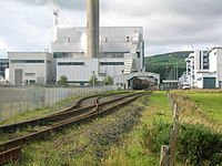
On the edge of the town lies a large chemical plant once operated by Roche, but now run by DSM, producing vitamins C and B5.
[21] The railway was double track and narrow gauge, working through a 'cable and pulleys' system on light steel rails.
The gravity railroad allowed the weight of the loaded cars, which were disconnected for unloading, to return the empty ones back up to the mine.
The surface of the inclined plane railroad was paved with firebricks, for employees to walk up the tracks to get to the main Dalry to Kilwinning road where they could catch a bus.
A formal footpath and a footbridge had been built by 1896 and various postcards show an ever more impressive path running beside the river that is named as the Lovers' Walk.
A footpath also ran down from Bridgend Lane to the new footbridge and this seems to have been or become part of the Lovers' Walk of Victorian and Edwardian times.
A rural school that lay near the Blair Estate is recorded in a photograph[23] and is shown on old Ordnance Survey maps.