Delta Amacuro
Delta Amacuro State covers a total surface area of 40,200 km2 (15,500 sq mi) and, in 2011, had a census population of 171,413.
[2] Based on theories, anthropological evidence and oral tradition, the antecedents of human activity within this territory date from the time of the first displacements through America; Groups from the eastern slopes of the Peruvian Andes were introduced into the Lower Orinoco, they are called Kotoch or Chavinses; They developed knowledge of pottery (of which formal and technical reminiscences in ceramics are kept), and horticulture.
With time other groups established themselves in its surface, the oral Tradition stands out among them the Barrancas, who through the cultivation of the bitter yucca reached a remarkable economic development and social structure, even with agricultural surpluses that could have stimulated some type of commerce through the monopoly of its production.
The most recent archaeological evidence of pre-Columbian human activity is attributed to the Warao Ethnic Group, according to verbally documented stories; its members joined as deserters from other hostile tribes, probably being displaced from the north of Brazil or the Eastern Savannah; currently some inhabitants of the state continue to identify themselves as part of this tribe and are a legally recognized group within its demography.
They were originally fishermen, hunters and gatherers, but later became farmers with the introduction of the Chinese Ocumo from the island of Trinidad and Guyana.
Vicente Yañez Pinzón in 1500 discovered the Delta and Diego de Ordaz, commander of the Order of Santiago, captain of Hernán Cortés, in 1532 climbed the Orinoco to the confluence with the Meta River.
During this century, several governors, both Spanish and English (from Trinidad) tried to join the Warao and structure them into populations, which caused their desertion to the territories of Suriname.
Alexander von Humboldt documented in his Journeys to the Equatorial Regions that the Waraos were the only indigenous people still outside the control of the Colony.
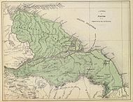
On February 27, 1884, the delimitation of the Delta Federal Territory was constitutionally established with an area of 63,667 km2, formed by the districts of Manoa and Guzmán Blanco, with Pedernales as its capital.
On October 21, 1893, the entity disappeared from the federal map, after being annexed to the state of Bolivar during international tensions with the United Kingdom over the area of the Delta claimed by British Guiana.
On April 26, 1901, it was restored under the name of Territorio Federal Delta Amacuro, composed of the districts of Barima and Tucupita.
In 1940 the Organic Law of the Federal Territory Delta Amacuro was promulgated, which divided it into the departments of Tucupita, Pedernales and Antonio Díaz.
4,295 of August 3, 1991, the Special Law was promulgated, giving the Territory the status of State, with the same political-territorial division as before.
In the last decade, Delta Amacuro has seen an important migration of criollo Venezuelans looking for jobs in the oil sector.
The region is located in the extreme east of Venezuela and its main geographical feature is the Orinoco River Delta (the most important and longest in Venezuela) with 18,810 square kilometers and the so-called Serrania del Imataca which has 21390 square kilometers and extends even to the neighboring states of Bolivar and Monagas.
The current governor is Lizeta Hernández Abchi, a member of the United Socialist Party of Venezuela (PSUV), who has been in office since 2008.