Dili
Centuries of Portuguese rule were interrupted in World War II, when Dili became the site of a battle between Allied and Japanese forces.
Under Indonesian rule infrastructure in the city was developed, with landmarks such as the Immaculate Conception Cathedral and Cristo Rei of Dili being built during this time.
Resistance to Indonesian rule faced violent repression, and a massacre in Dili led to international pressure culminating in an independence referendum.
[4]: 10 In the late 1500s, administrative officials began to be appointed to nearby Solor with jurisdiction over that island and Timor, signifying increasing state interest in Portuguese activities there.
[2]: 210 In 1769, as Lifau came under the increasing influence of powerful local families collectively known as the Topasses, the Portuguese governor António José Teles de Meneses moved the administration and 1,200 people east to establish a new capital.
[2]: 212–215 When English naturalist and explorer Alfred Russel Wallace visited in the 1860s, he wrote that the governor's house was "merely a low whitewashed cottage", and that all other buildings appeared to be mud and thatch.
[11] During World War II, Portugal and its colonies remained neutral, but the Allies saw East Timor as a potential target for Japanese invasion.
[18]: 280–281 This plan was not completed, and the city remained under-developed,[6]: 18, 53 with low density and where property outside of the central area was still built on with flimsy materials and used for subsistence cultivation.
Structures and monuments built during this time include the Immaculate Conception Cathedral, the Integration Statue commemorating the end of Portuguese rule, and the Cristo Rei of Dili.
[1]: 10 Nonetheless, towards the end of the decade Indonesia began allowing foreign tourists access to the city, with the entire province previously being restricted.
[3]: 17–18 The 1997 Asian financial crisis along with a drought related to an El Niño event led to profound food insecurity, worse for Dili than any other city in Indonesia.
As Indonesian infrastructure investment outside of Dili was not replicated by the UN government, leaving it to deteriorate, population growth was driven in part due to internal migration from these areas to the city.
[1]: 15 From 1990 to 2014, agricultural use of the flat land around Dili is thought to have decreased by around 40%, replaced by horticulture and aquaculture in the east and by urban areas in the west.
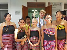
The campaign included dialogues between different sectors of Timorese society, a cycling tour, a Dili marathon, and a reforestation initiative.
[32][33] Focusing the peace campaign on Dili reflects the influence it has on the entire country, with the government expecting its impacts would extend beyond the city itself.
[34]: 161 The Latelek (Bridge) Project was instituted from 2010 to 2012 by some organs of the Catholic Church to improve community cohesion, reintegrating previously displaced individuals with those who had remained.
[11][17]: I-4 To the south is the central mountain range running through Timor,[1]: 7 which extends north to the coast on the west and east surrounding the core city.
[17]: 5–9 Parts of the city are considered to face drought hazards and flooding risk from rivers, issues related to climate change.
[17]: 2–16 [42]: 4, 14 The coral reefs off Dili appear to be locally sheltered from the average sea surface temperature rise from climate change.
The 3.8 kilometres (2.4 mi) Tasitolu area lies near the border of the Dili and Liquiçá municipalities, and covers land and some coastal waters.
[17]: I-4, 2–14, 2–15, 3–10 [46] Near-threatened bird species found in these protected areas include the black cuckoo-dove, the pink-headed imperial pigeon, and the Timor sparrow.
[6]: 81–86 Portuguese-era buildings are most common in the Motael, Gricenfor, and Bidau Lecidere sucos,[17]: I-8 often stretched along the main road running through the old part of the city, the Avenida Nicolau Lobato [de].
[22]: 84 The Cristo Rei of Dili is a 27-metre (89 ft) tall statue of Jesus situated on top of a globe at the end of the eastern Fatucama peninsula.
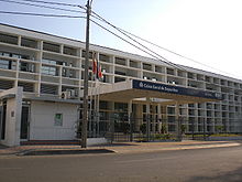
[citation needed] The current president of the Dili Municipality Authority is Gregório da Cunha Saldanha, sworn in on 1 March 2024.
[28]: 226 In 2004 18,331 people were working in the agricultural sector, 1,885 in resources and manufacturing, 5,027 in hospitality, 3,183 in finance, real estate, and logistics, 6,520 in government services and security, 879 in home industries, 6,354 for international diplomatic bodies, and 2,142 unknown.
[17]: 1–1 Pre-independence laws prohibiting building within 100 metres (330 ft) of water bodies are not enforced, with population growth leading to structures such as housing being built in flood-prone areas, including along dry river beds and canals.
Existing water sources and transportation infrastructure are considered sufficient to meet the immediate needs of the city, although work continues to improve quality and reliability.
[29]: 264, 272–274, 277 Despite the inconsistency of supply, 91% of those in urban areas have some access to safe drinking water,[28]: 226 with sources including pumps, public taps, and wells and boreholes.
[38]: iii The usual form of public transportation within the city is the minibus, which are operated by private companies that purchase route franchises from the government.
[34]: 63–68 The City of Peace campaign seeks to maintain stability in the capital by bringing youth together for common discussions and by promoting a shared sense of national pride.