Douglas Range
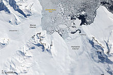
The Douglas Range (70°0′S 69°35′W / 70.000°S 69.583°W / -70.000; -69.583) is a sharp-crested range, with peaks rising to 3,000 metres, extending 120 km (75 mi) in a northwest–southeast direction from Mount Nicholas to Mount Edred and forming a steep east escarpment of Alexander Island within the British Antarctic Territory, overlooking the north part of George VI Sound.
The resulting aerial photographs were used by Ellworth's compatriot WLG Joerg for a rough cartographic survey.
The eastern flank of the range was surveyed superficially in 1936 from George VI Sound by participants in the British Graham Land Expedition (1934–1937) under the direction of the Australian polar explorer John Rymill.
The entire range, including the west slopes, was mapped in detail from air photos taken by the Ronne Antarctic Research Expedition (RARE), 1947–48, by Searle of the FIDS in 1960.
The Douglas Range was named by the BGLE, 1934–37, for V. Admiral Sir Percy Douglas, chairman of the BGLE Advisory Committee, member of the Discovery Committee from 1928 until his death in 1939, formerly hydrographer of the Royal Navy.