Downtown Albany Historic District
On the east it is bounded by the Hudson River and Interstate 787, with Eagle Street its western side (excluding City Hall, the state Court of Appeals and the county courthouse).
[2] Albany was a point of contention during both the French and Indian and Revolutionary wars, and the New York State Legislature met there in 1780 after British occupation ended.
The opening of the Erie Canal in the 1820s and the development of railroads in later decades made the city a transportation hub, and as its commercial power and the state's grew it assumed more political importance.
Another church, St. Mary's, by the local firm of Nicholls and Brown, became the focal point of a neighborhood of small houses on and near Lodge Street.
[2] In the years after the Civil War commercial interests started building taller and more massive edifices along North Pearl and State streets.
Albany native Edward Ogden designed the 1873 Kenmore Hotel on North Pearl, and expanded it in 1891 with Queen Anne touches.
Another local architect, Albert Puller, had given downtown the YMCA building at 60 North Pearl, in that style three years earlier.
Near the end of the period of significance, Dennison and Hiron's Art Deco Home Savings Bank Building was the tallest in Albany at the time of its 1927 completion.
No major building took place downtown in the 1930s due to the combination of it being built out and the slowdown in construction occasioned by the onset of the Great Depression.
Downtown remained a popular place for politicians and those who associated with them to patronize, but otherwise began to decline in a similar fashion as other old Northeastern cities.
A large pedestrian mall was proposed for the area between Chapel and Broadway, with the intervening blocks of Steuben, Pearl and Pine to be closed off to vehicles.
Eventually, it was hoped, a people mover system would be built to link Empire Plaza and downtown, with new parking garages on the fringes, one of which would have required rerouting Liberty Street and Hudson Avenue.
This cleared 98 acres (40 ha) southwest of downtown for a complex centered on five tall state office buildings in high modernist style.
When completed in the late 1970s, Empire State Plaza became the new centerpiece of the city's skyline, and Erastus Corning Tower its tallest building.
In the late 1980s Sebba Rockaway, a British developer, proposed to demolish a row of buildings, all contributing, at 136–40 State Street and replace them with a 14-story office complex.
The buildings continued to deteriorate, and in 2004 a section of State Street was closed since part of the Wellington's cornice was in danger of falling into it.
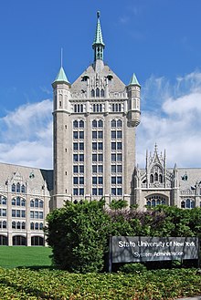
[10] In 2022, the state proposed to the National Park Service (NPS) some changes to the district as a result of additional research into its history and developments since then, which were accepted in May.
In addition to fuller histories for some existing pre-1928 contributing properties such as the Home Savings Bank Building, the boundary increase added the Park Mart at North Pearl and Van Tromp streets, itself listed on the Register in 2021.
It had been deliberately excluded at the time the district was designated but now reflects that era of its history; similarly the equally modernist former Adirondack Trailways bus terminal at Broadway and Division, near the south end of the district, is now considered contributing, along with a small brick late 1940s commercial building at 55 Columbia Street and the IBM service building at 119 State Street.