East Dundry
The iron-age Maes Knoll tump (2.5 kilometres to the east) and tumuli (in the field just north-east of North Hill Farm) are evidence of long occupation of the valley.
The original settlements probably owed their existence to the quarrying of the local Dundry stone, which is found at Cardiff Castle and was used in mediaeval Bristol.
Nearby Dundry originally had a Roman fort built as part of the local defences against Anglo-Saxon invasions.
Bristol, with its centre only 6 kilometres away, had mains water, electricity, gas, and dial telephones by the 1930s – but the Second World War and its ten years of ensuing austerity stopped all extension of these facilities to places such as East Dundry.
The Dundry Post Office was a few houses south of the Carpenter's Arms pub and its north-side neighbour the smithy, all strategically in Cold Harbour on the Bristol-Wells stage-coach mail road.
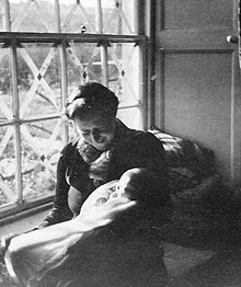
A week or so before war was declared, several London children were evacuated to East Dundry: for instance two were billeted to Spring Farm, two to The Dingle and some to The Rookery.
The houses and farms built before about 1890 (and dating back to mediaeval and earlier times) are all geologically close to the division between clay and the higher layer of Dundry hill's oolitic limestone[5] – this allowed wells to be sunk for them, with a reliable supply.
The farms needed ample water for their dairy herds prosperously supplying milk to Bristol by horse and cart.
The rhythmic thumping of the ram had a shorter frequency than the one mentioned at North Hill Farm with gentle knocks about every 3 to 4 seconds.
In a few years every joint of this relatively high-pressure-gas steel pipeline had to be resealed when the supply was converted from town to natural gas.
The previously partially-melted light and fluffy snow formed dense solid ice on the thin copper telephone lines increasing their weight.
The multiple overhead open-wire phone lines were after the winter replaced by a single multi-core cable suspended from the poles.