East Granby, Connecticut
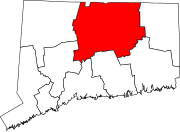
East Granby is a town in the Capitol Planning Region, Connecticut, United States.
[2] Original inhabitants of the current East Granby area were Native American peoples, including the Algonquin/Poquonock, the Massaco, and the Agawam.
[3] The East Granby area was first settled by Europeans in 1664, which was one of the four Congregational parishes in Simsbury.
The early twentieth century saw local farmers specializing in dairy product and tobacco.
East Granby experienced a housing boom that started in 1951 and resulted in a rise in population.
The Metacomet Ridge, a mountainous trap rock ridgeline that stretches from Long Island Sound to nearly the Vermont border, runs through the center of the town, cutting off Salisbury Plain to the east, which used to lie under the ancient, glacial Lake Hitchcock.
High points on the Metacomet Ridge in East Granby include Hatchet Hill and Peak Mountain; the latter offers a bird's eye view of the historic Old Newgate Prison.
The East Granby Historical Society can be found on North Main Street.
[16] Once strongly Republican, East Granby has become friendlier to Democrats in recent elections, similar to other suburban areas.
[18] In 2016, this was one of ten Connecticut towns to flip from Republican to Democrat, albeit giving Hillary Clinton a victory of only 18 votes.