East River Greenway
Some places are narrow due to sinkholes being blocked off by protective fencing, and one part squeezes between the highway and the dock of Con Edison's East River Station, requiring slower speeds.
[1][2] In the summer of 2008 the East River Greenway, along with the Brooklyn Heights Promenade, provided viewing locations to see the New York City Waterfalls.
In October 2011, the city and state reached an agreement to use the western portion of Robert Moses Playground at 41st Street for an expansion of the United Nations Headquarters campus.
[4][19][23][24] This section includes a new ADA-accessible bridge across the FDR Drive at 54th Street that provides a connection to the north end of Sutton Place Park South.
[26] The greenway segment was originally planned to utilize concrete pilings left in the river from a temporary outboard roadway that served as a detour for traffic during reconstruction of the FDR Drive.
New piles were driven to depths down to 130 feet (40 m) and were socketed into bedrock to support a 40-foot-wide (12 m) deck made of sections of precast concrete that has bike and pedestrian paths with a stormwater catchment system to irrigate the trees and plantings.
[33] South of the United Nations, the greenway enters East River Esplanade Park via a pedestrian underpass at 37th Street.
[18][34][35] The park cost over $4 million and was designed by Thomas Balsley Associates, the same firm that had prepared a 1987 master plan for the future development of a waterfront esplanade between 41st and 34th streets for Community Board 6.
On the north and south of the entrance plaza, the rear sections of the esplanade were slightly elevated on a podium to provide unobstructed views of the river.
[39] The site of the park had been previously proposed as the location of two 27-story apartment buildings to provide more housing for families of United Nations staff—a project that would have also included the development of a public promenade along the waterfront from 36th to 51st streets.
[40] The north end of East River Esplanade Park currently provides the only connection to Waterside Pier, which runs from 38th to 41st streets.
The section of the esplanade between 34th and 36th streets was improved in the mid-2000s with installation of new pavement, benches, landscaping, lighting, and railing as part of upgrades made to the adjacent ferry landing.
[41] The waterfront promenade on the north side of The Water Club was designed by M. Paul Friedberg and built by the restaurant as a required public amenity.
[44][45] The greenway portion and the apartment buildings that make up Waterside Plaza (as well as the neighboring United Nations International School) were constructed on top of platforms supported by over 2,000 concrete piles sunk into the East River.
Surplus cement dumped from trucks into the East River has created a small beach in the middle of the park near the end of 20th Street.
[58][59] From 2020 to 2023, the entire park was demolished and reconstructed in order to build a new floodwall with flood gates as part of the city's East Side Coastal Resiliency project.
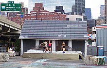
[60][61] Solar 1, an environmental learning center with a small outdoor stage for public performances, is located at the north end of the park.
[64] The 2013 East River Blueway plan recommended replacing a bottleneck on the greenway located near 14th Street with an elevated path above the FDR Drive.
This portion of the path narrows to 4 to 5 feet (1.2 to 1.5 m) in width adjacent to Con Edison's East River Generating Station.
[65][66] Footings for the new flyover bridge, which will span over the FDR Drive from 13th to 15th streets, are being installed as part of the city's East Side Coastal Resiliency project.
[69] The park includes football, baseball and soccer fields, tennis, basketball and handball courts, a running track, and bike paths.
Upon completion in 2015,[70] the East River Esplanade is slated to feature three rebuilt piers (14, 15, and 35) new glass pavilions underneath the elevated FDR Drive, new bike lanes, recreational facilities, and waterfront seating.
[72] The busy waterfront provided easy access to New York Harbor and the Atlantic Ocean in the south, the Hudson River on the west, with a connection to the Erie Canal.
Noting the success of the World Financial Center, the East Side Landing plan was created in the 1980s to add commercial and office buildings along the waterfront, again south of Fulton Street, similar to Battery Park City.
Drawbacks exist however:[77][78] During Michael Bloomberg's tenure as mayor, he spearheaded the PlaNYC 2030 initiative, which highlights projects and plans to transform the city by the year 2030.
The Pier 11/Wall Street ferry terminal has long operated East River waterfront, with regular trips to New Jersey.
SHoP Architects led the design process in the creation of the East River Esplanade, consulting community members during the planning years between 2002 and 2006.
[80][81] Access to the Esplanade from the neighboring areas would be undertaken with the redevelopment of "slips" - wedge-shaped road shapes which previously allowed ships to berth.
Reconstructions of the existing slips in the Financial District, the Lower East Side and Chinatown will feature bikeways and landscaped medians.
[91] In addition to storm protection, the berm—the first of three of the barrier's components—will also provide a pedestrian pathway and bikeway on top of berm, boating and fishing docks, a slope down to current sports fields, upgraded ADA-accessible ramps for bridges across the FDR Drive, and construction materials such as "slurry walls, concrete blocks, a compacted embankment, a clay cap, topsoil and salt-tolerant landscaping.