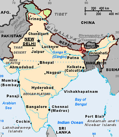
Eastern South Asia
Yunnan Province and the Tibet Autonomous Region of the People's Republic of China (PRC) and Myanmar are historically, economically, and culturally interdependent on Eastern South Asia.
Eastern South Asia's archaeological heritage includes Lumbini, the birthplace of the Buddha; the ancient universities and monasteries of Nalanda, Vikramshila, Somapura Mahavihara, Jaggadala, Odantapuri and Mainamati; the Ashokan pillars and the Mauryan Empire-era cities of Pataliputra, champa, Vaishali, Balirajpur, Rajgir, Sisupalgarh, Kalinga and Mahasthangarh; and the ruined fort cities of Wari-Bateshwar, Bhitagarh, and Chandraketugarh.
Historical states in the region include those recorded in Indian epics such as the Mahabharata, including ancient Nepal, Vanga, and Pundra; the Greek and Roman recorded kingdom of Gangaridai;[5] major Hindu and Buddhist kingdoms including Kikata, Videha, Vṛji, Magadha, Nanda, Mauryan, Anga, Kalinga, Kamarupa, Samatata, Kanva, Gupta, Pala, Gauda, Sena, Khadga, Candra, Deva, Tripura, and Cooch Behar State.
[7] Citing administrative improvement and affirmative action for Bengali Muslims and non-Bengali communities in colonial Assam, the British government enacted the first partition of Bengal in 1905.
But the first partition sparked strong protests from elites in Calcutta and sections of the landed gentry, particularly Bengali Hindus.
Following the Tibetan crisis, India and the PRC engaged in a brief border war in 1962 over the disputed McMahon Line and Aksai Chin areas.
[13] In 2012, India affirmed in principle to allow Bangladesh, Bhutan, and Nepal to transit its territory for trade movement.
[20][21] The rapid development of the Chinese economy has caused increased trade and economic activity between China and Eastern South Asia.
The geography of Bangladesh is varied and has an area characterised by three distinct features: a broad deltaic plain subject to frequent flooding, elevated forested plateaus, and a small hilly region crossed by swiftly flowing rivers.
On the south is a highly irregular deltaic coastline of about 580 kilometres (360 mi), containing many parallel rivers and streams flowing into the Bay of Bengal.
The land consists mostly of steep and high mountains crisscrossed by a network of swift rivers, which form deep valleys before draining into the Indian plains.
The landlocked region of Northeast India includes the states of Assam, Arunachal Pradesh, Mizoram, Manipur, Meghalaya, Nagaland, Sikkim, and Tripura.
The states of Arunachal Pradesh and Sikkim have a montane climate with cold, snowy winters and mild summers.
These ecological belts run east–west and are vertically intersected by Nepal's major, north to south-flowing river system.
The Mountain Region (Himal), situated in the Great Himalayan Range, makes up the northern part of Nepal.
Its major trading partners include the European Union, the United States, China, India, Japan, Australia, Malaysia, and Singapore.
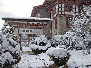
The economy of Bhutan is notable for its hydropower, ferroalloys, apples, red rice, construction materials, and tourism sectors.
Bhutan's main trading partners are India, Bangladesh, Thailand, Hong Kong, Japan and South Korea.
Bhutan ranks first in economic freedom and ease of doing business, is second in per capita income, and is the least corrupt country in South Asia.
A cross-border conveyor belt carries limestone from mines in Meghalaya, India, to Sylhet Division, Bangladesh, to supply a Lafarge cement plant.
The economy of Nepal relies heavily on tourism, agriculture, food processing, metal production, remittances, carpet making, and textile manufacturing.
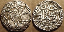
In the 17th century, Mughal Bengal generated 50% of India's GDP due to its worldwide muslin and silk exports.
The legal system of Bhutan is a mixture of the semi-theocratic Tsa Yig code and English common law influences.
Nepal ranked 63rd on the 2016 Rule of Law Index compiled by the World Justice Project, which was higher than India, Bangladesh, and Pakistan.
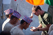
Nepal's military has historically enjoyed a close association with the British armed forces due to the recruitment of Gurkhas.
[40] Prior to the partition of British India, a regime of freedom of trade and transport existed in the region, including free ports in Calcutta, Narayanganj and Chittagong.
[42] After the independence of East Pakistan, Nepal signed a Transit Agreement with Bangladesh in 1976, even though cross border transport through India remained suspended since 1965.
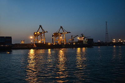
[44] The proposed transit is focused on international seaports in Chittagong and Mongla, as well as the Bangladesh Railway and inland waterways.
[48] In 2017, the World Bank announced a US$150 million financing agreement for improving infrastructure to develop a transit regime.
[50] Northeast Indian states import internet bandwidth by using the Bangladeshi submarine cable in the Bay of Bengal.