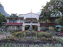
El Nido, Palawan
[3] A managed resource protected area,[5] it is known for its white-sand beaches, coral reefs, and limestone cliffs, as well as for being the gateway to the Bacuit archipelago.
Chinese traders regularly visited the area of Palawan for its edible birds' nests during the Song dynasty (960–1279).
Chau Ju-Kua, a trade commissioner of the port of Chuan, wrote about the island, Pa-Lao-Yu or Land of Beautiful Harbors, in his book Chu Fan Chi.
[5] In 1957, the following barrios were created: El Nido is situated in Bacuit Bay and covers a land area of 465.1 square kilometres (179.6 sq mi).
[12] Together with Sulu Archipelago, Sabah, and the South China Sea, El Nido, being part of Palawan, is located in the tectonically active and seismically active Sunda Plate,[13] a plate that is entirely separate from the Philippine Mobile Belt to which the rest of the Philippines belongs.
The Permian to Paleogene rocks and limestone cliffs of El Nido are similar to those that can be found in Ha Long Bay in Vietnam, Guilin in China, as well as Krabi in Thailand, all of which are part of the Sunda Plate.
A small but significant percentage of the population speaks or comprehends Cuyonon, the native language of the Cuyo Islands and most parts of Palawan.
The vice mayor heads the legislative council consisting of eight councilors, more commonly known as Sangguniang Bayan members.
518, establishing a 360 square kilometres (140 sq mi) maritime area in El Nido as a turtle sanctuary.
In 1991, the rest of Bacuit Bay, including its island and islets, was proclaimed by the Philippine government as a marine reserve.
In 1998, its status was elevated to that of a protected area, including the terrestrial ecosystem of El Nido and portions of Taytay.
[40] The El Nido-Taytay Managed Resource Protected Area is the largest marine sanctuary in the Philippines.
The Palawan Council for Sustainable Management (PCSD) provides legal assistance during the litigation of cases filed by the Protected Area Office (PAO).
08 series 2000 from the National Integrated Protected Area Program (NIPAP) of the Department of Environment and Natural Resources (DENR).
[38] El Nido, one of the country's most diverse ecosystems, is protected for its unique flora, fauna, and pristine geologic formations.
Its interconnected roads are connected to the major highway that leads to Puerto Princesa, Palawan's capital.
Daily buses and jeepneys depart at San Jose Terminal in Puerto Princesa for El Nido.
The 60 kilometres (37 mi) national road between Taytay and El Nido was rehabilitated, and this has helped boost tourism and business activity in the area.
Ten percent of the population can avail of the 'Level II Water System', or communal faucet,[48] by the municipal government, while the majority of them are still dependent on deep wells and natural springs.
Recently, the Palawan State University opened its El Nido campus in New Ibajay, offering extramural programs and studies.