Ellesmere Canal
The Ellesmere Canal was a waterway in England and Wales that was planned to carry boat traffic between the rivers Mersey and Severn.
The proposal would create a link between the Port of Liverpool and the mineral industries in north east Wales and the manufacturing centres in the West Midlands.
However, the canal was never completed as intended because of its rising costs and failure to generate the expected commercial traffic.
The branch, from which the waterway now takes its name, was primarily a water feeder from the River Dee above the town.
They wanted the canal's course to follow a more westerly route from the Dee to the Severn passing directly through the Welsh mining areas.
Notable civil engineer William Jessop was called into advise; he too recommended the route surveyed by Duncombe.
Close to the Eglwyseg and Ruabon mountains, there were deep river valleys to be crossed and high ground to be tunnelled.
In 1796, Thomas Telford constructed a feeder reservoir lake in Moss Valley, Wrexham to provide water to the length of canal between Trevor Basin and Chester.
However, as the plan to build this section was cancelled in 1798, the isolated feeder and a stretch of navigation between Ffrwd and a basin in Summerhill was abandoned.
As the canal would now not reach its proposed main source of water northwest of Wrexham, a feeder was constructed along the side of the Dee valley to Horseshoe Falls at Llantysilio.
As this left the middle part isolated from the rest of the UK waterways network, the planned Whitchurch branch was re-routed.
A 29-mile (47 km) link was built from Frankton via Ellesmere to the Chester Canal at Hurleston Junction in sections between 1797 and 1806.
A branch was also originally intended to reach Prees in Shropshire; however the line was only constructed as far as Quina Brook, 1-mile (1.5 km) from the village.
The isolated section from Chester to Ellesmere Port is considered part of the Shropshire Union Canal main line.
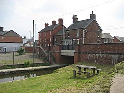
The Weston Branch is now infilled save for a very short section which has a Canal & River Trust amenity block.
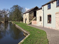
Originally goods would be transferred directly from inland waterways craft into river-going vessels at the dock, which would enter and exit through tidal lock gates.
The section from Frankton Junction to Lockgate Bridge (where the branch meets the Weston Arm) was originally intended to be the main line of the Ellesmere Canal.
The 5+1⁄2-mile-long (9 km) arm had wharves at Hordley, Dandyford, Pedlar's Bridge, Shade Oak and Weston Lullingfields.