Homs
Before the Syrian civil war, Homs was a major industrial hub with a population of at least 652,609 people in 2004,[13] it was the third-largest city in Syria after Aleppo to the north and the capital Damascus to the south.
Homs did not emerge into the historical record until the 1st century BC in the Seleucid Empire, becoming the capital of a kingdom ruled by the Emesene dynasty who gave the city its name.
At its greatest extent, the Arab kingdom's boundaries extended from the Bekaa Valley in the west to the border with Palmyra in the east, and from Yabrud in the south to al-Rastan (Arethusa) in the north.
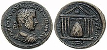
[19] The city of Emesa grew to prominence after the new-found wealth of the Emesene dynasty, governed first by one of the sons of Sampsiceramus I, Iamblichus I who made it the kingdom's capital.
[19] The Emesene proved their loyalty to Rome once more when they aided Gaius Julius Caesar in his siege of Alexandria in 48 BC, by sending him army detachments.
The Byzantine emperor Heraclius abandoned the city, which served as his headquarters,[55] after his army's defeat by the Rashidun Caliphate under Umar during the Battle of the Yarmuk (now the Jordan–Syria border).
In 637 CE, the Rashidun army, led by Khalid ibn al-Walid, captured Emesa peacefully because its inhabitants agreed to pay a substantial ransom of 71,000 to 170,000 dinars.
[59] In 638, Heraclius sought help from the Christian Arab tribes in Upper Mesopotamia, mainly from Circesium and Hīt, and they mustered a large army and besieged Emesa.
However, the siege was a failure, as the coalition forces lost heart and abandoned the city as at the time Iyad ibn Ghanm invaded their homeland in an effort to counter their act.
[64] With Abbasid rule over the Caliphate weakening in the mid-9th century, Homs became sought after by rebel dynasties contending for control of Syria due to the city's strategic position.
Initially, the Egypt-based Tulunids came into control of it, but they were forced out by the Aleppo-based Hamdanids, who were briefly succeeded by the Qarmatians,[49] after the latter's Turkish rebel ally Alptakin invaded northern Syria and established Homs as his base.
[67] For around thirty years during the 10th century, Homs was raided by the Byzantines led by Nikephoros II Phokas in October 968, and its inhabitants were subject to slaughter and plunder while the Great Mosque of al-Nuri was briefly restored as a church.
Inclined towards Shia Islam, they did not oppose the Isma'ili Shi'i Fatimid Caliphate of Egypt, which was aiming to extend its rule into northern Syria and Iraq at the time.
Soon after, Homs came under the control of the Saljuqid ruler of Damascus, Duqaq, who transformed it into a large, fortified camp and key fortress effectively preventing the Crusaders from penetrating deeper into Muslim territory.
[70] Muslim geographer al-Idrisi noted in 1154 that Homs was populous, had paved streets, possessed one of the largest mosques in Syria, contained open markets, and was frequented by travellers attracted to its "products and rarities of all kinds."
Nevertheless, he did not sack it as he did in Aleppo, Hama and later Damascus, due to a man called "'Amr bin al-Rawas" who conciled with him offering precious gifts to save the city.
[70] In 1516, Homs was incorporated into the Ottoman Empire and consequently suffered a greater political eclipse, but it continued to thrive as an economic center, processing the agricultural and pastoral products that flowed to it from surrounding districts.
In addition to weaving industries, there were olive oil presses and water mills for wheat and sesame, while grapes and rice, grown in the surrounding marshlands from the 16th century, were found in abundance in the city's markets.
Moreover, the markets of Homs were the center of a trade in livestock, where flocks of sheep and goats coming from Aleppo met camels and cattle moving north from Damascus.
[83] The countryside of Homs saw an increase in Bedouin raids in the first half of the 19th century, interrupted by its occupation by Muhammad Ali's Egypt led by Ibrahim Pasha between 1832 and 1840.
Ottoman rule was soon restored and up to the 1860s, Homs was large enough to form a discrete economic unit of trade and processing of agricultural products from its satellite villages and the neighbouring Bedouin tribes.
[12] Nearby towns and villages include al-Rayyan to the southeast, Maskanah, al-Nuqayrah, Abil and Kafr Aya to the south, al-Qusayr, Qattinah and al-Buwaydah al-Sharqiyah to the southwest, Khirbet Tin Nur to the west, al-Dar al-Kabirah to the northwest, al-Ghantu, Teir Maalah, al-Mukhtariyah and Talbiseh to the north, al-Mishirfeh to the northeast and Fairouzeh and Zaidal to the east.
The suburb of al-Waer is located even further west, separated from the city by areas of farmland called al-Basatin and the Orontes River forming a green belt where it is forbidden to build anything.
[110] Today, Homs' population reflects Syria's general religious diversity, and is made up primarily of Sunni Muslims (including Arabs, Kurds, and Turkmen), with minorities of Alawites, Eastern Orthodox Christians and Assyrians.
The "Homs Irrigation Scheme", the first of its kind in modern Syria, brought prosperity to cultivators and the long-established enterprises involved in the processing of agricultural and pastoral products.
[117] Crops grown in Homs include wheat, barley, lentils, sugar beets, cotton, and vines, as well as serving as a point of exchange between the sedentary zone and the desert.
In the Old City, low-price restaurants are grouped together along Shoukri al-Quwatly Street and sell similar foods, such as hummus, falafel, various salads (mezze), shish kebab and chicken dishes.
Qasr al-Zahrawi, a former Mamluk-era palace belonging to Ali ibn Abi al-Fadl al-Azzhari, a subordinate of Baibars, the Mamluk sultan, is now the National Folklore Museum.
Hama Street starts at the Old Clock Square in the city center and crosses Homs from south to north, where it continues along the neighbourhood of al-Khaldiyah on to the Karnak station, and turns into the Homs-Hama-Aleppo highway.
These consist of a complex maze of narrow streets and covered commercial alleys extending from the south and east from the Great Mosque towards the ancient citadel.