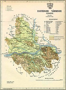
Esztergom County
Esztergom County (Latin: comitatus Stringoniensis, Hungarian: Esztergom (vár)megye, Slovak: Ostrihomský komitát / Ostrihomská stolica / Ostrihomská župa, German: Graner Gespanschaft / Komitat Gran) was an administrative county of the Kingdom of Hungary, situated on both sides of the Danube river.
The capital of the county was the Esztergom Castle and the town of Esztergom, then from 1543 onwards, when the territory became part of the Ottoman Empire, the county officials fled to Nagyszombat and Érsekújvár, the latter functioning as a seat (e. g. 1605–1663) and finally since 1714 the previous situation was restored.
A predecessor of the county existed as early as in the 9th century, when Esztergom (Slovak: Ostrihom) was one of the most important castles of Great Moravia.
In 1850 Komárom and Esztergom counties were divided along the Danube: the areas north of the river (along with a small part of Győr County on the north bank and the Szőny suburb of Komárom on the southern bank), including Esztergom's Muzsla Stuhlbezirk ('seat-district'), were combined into a new Komárom county (under the German name Comorn) administered by the Military District of Preßburg; the southern parts of the traditional Komárom and Esztergom counties (the Gran (Esztergom) Land- and Stadtbezirke and Komárom's Kócs and Dotis Stuhlbezirke) were merged to form a new Gran (Esztergom) county administered by the Military District of Pest-Ofen.
After World War II, the Trianon borders were reestablished and Komárom-Esztergom County was recreated again.