Euclid Creek
[23] This ice sheet not only shaped the relief of the land—leaving behind low rounded hills, irregular plains, and depressions that turned into wetlands[5]—but also left glacial till and erratics over most of the bedrock.
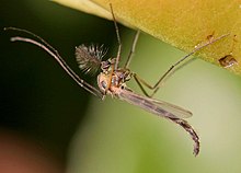
[4] The Chagrin Shale exposed by Euclid Creek contains many different arthropod fossils, including Camarotoechia, Lingula, Nucleata, Orbiculoidea, and five species of Echinocaris.
[49] Emerging from this gorge about where Euclid Avenue and Chardon Road meet today, the creek meanders across the Erie Plain,[46] a relatively flat area with low, rolling hills.
Between the park and Interstate 90, Euclid Creek is highly channelized, although a riparian zone exists on either side that shields the stream from the dense urban development adjacent to it.
Limited illegal dumping occurs in the park, and the creek's water quality is affected by polluted surface runoff from nearby residential areas after heavy storms.
A 2003 study by the Northeast Ohio Regional Sewer District (NEORSD) found that 16 miles (26 km) of Euclid Creek showed moderate to high levels of erosion due to channelization.
[87] The nearshore environment at the mouth of the creek was also in poor condition, with high levels of ammonia, copper, iron, manganese, nickel, total phosphorus, and zinc.
[91] The city of Willoughby Hills inaugurated a four-year sewage improvement project (the Euclid Creek Tributary Interceptor) in May 2000 designed to end sewage overflows into the east branch of Euclid Creek[92] According to samples taken in 2000, levels of fecal coliform had dropped in the main and east branch below federal water quality standards, although several tributaries still did not meet the standard.
[99] Euclid Creek failed fecal coliform standards 59 percent of the time in 2008, making it one of the ten most polluted swimming spots in the nation, according to the Natural Resources Defense Council.
[7] Although no known endangered or threatened amphibian, fish, invertebrate, or mammal is known to exist in the Euclid Creek watershed, the lack of extensive studies means that their presence cannot be ruled out.
The only known stable population of this plant species in Ohio is found in Highland Heights Community Park near the headwaters of a tributary of the east branch of Euclid Creek.
[138][u] Several of these ridge trails crossed Euclid Creek, and served as the primary route by which white explorers and settlers began moving west into northern Ohio.
[11] White settlement of the Euclid Creek area began when some log cabins were erected on the shore of Lake Erie east of the stream probably in the summer of 1795. Who built them, and why, is not known, and they were abandoned by the spring of 1796.
[158] During the war, American soldiers on horseback were stationed at the mouth of Euclid Creek to provide warning to other settlements in the area in case British ships should stop or pass by.
[164] About 1840 (or just before), Ruel House, Charles Moses, and Captain William Trist opened a shipyard on the east side of the mouth of Euclid Creek where they constructed canal boats.
[46] One of the first large grape-growing operations was founded in 1864 by German immigrant Louis F. Harms on 40 acres (0.16 km2) in the area now bounded by Euclid Avenue, Chardon Road, and Dansy Drive.
[182] This railroad, which largely ran parallel to and south of the Lake Shore and Michigan Southern Railway (the former Cleveland, Painesville & Ashtabula),[183] passed through the Village of Euclid Creek, making it an important stopping point again.
[200] Cuyahoga County wanted to push Highland Road southwest through the Euclid Creek Reservation, but the onset of World War I delayed the start of construction until 1920.
The following year, the park board proposed purchasing the main branch of Euclid Creek and its associated valley from Lake Erie south to Shaker Heights.
A barracks was erected at the intersection of Euclid Avenue and Highland Road,[219] and over the next three years the CCC workers cleared land, planted trees, and built picnic areas, trails,[219] and parking lots.
[246] The project, designed to provide the city's fast-growing east side with fresh water from Lake Erie rather than from Euclid Creek, other streams, and groundwater wells, was first proposed in 1925 and set for completion in 1930.
[275] In 1976, the Rouse Co. announced it would construct a $25 million ($133,900,000 in 2023 dollars) shopping mall, Beachwood Place, on 50 acres (0.20 km2) of land owned by the Ratner family on the southeast corner of Richmond and Cedar Roads.
[276] The mall (whose cost rose to $30 million ($160,600,000 in 2023 dollars) within four months)[277] began construction atop a portion of the headwaters of the main branch of Euclid Creek[278][279] in August 1977.
and the lake was straightened,[283] the creek north of Euclid Avenue widened and deepened,[285] and an additional 600 feet (180 m)[222] of the banks and streambed covered in concrete[283][285] at a cost of $2.12 million ($6,500,000 in 2023 dollars).
[290] As Cuyahoga County embarked on a $4.5 million ($12,100,000 in 2023 dollars), state-funded Euclid Creek flood control project in the fall of 1987, the city and state began planning to purchase the Villa Angela lands and convert them to a public park.
[296][297] The library system agreed to keep a part of its acreage parkland, and allowed ODNR to construct a road through this area to provide improved access to the new park at the creek's mouth.
In October 1994, the Cuyahoga Soil and Water Conservation District (CS&WCD) concluded that the widening project had contributed to extensive flooding in Willoughby Hills.
Water quality and velocity in Euclid Creek was of a major concern to the group, which tentatively set plans to restore meanders to the stream as an initial goal.
The Ohio EPA released in 2005 a study (required by the federal Clean Water Act) which concluded that alteration or removal of the St. Clair Spillway would greatly improve invertebrate and fish populations in the creek.
The two-month-long project removed gravel, sand, wood, and trash which degraded habitat and inhibited water flows in Euclid Creek's manmade channel between Lakeshore Boulevard and Villaview Road.