Euboea
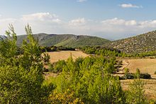
Its geographic orientation is from northwest to southeast, and it is traversed throughout its length by a mountain range, which forms part of the chain that bounds Thessaly on the east, and is continued south of Euboia in the lofty islands of Andros, Tinos and Mykonos.
[4] Its ancient and current name, Εὔβοια, derives from the words εὖ "good", and βοῦς "ox", meaning "(the land of) the well(-fed) oxen".
This is fairly probable, because it lies in the neighbourhood of a fault line, and both Thucydides and Strabo write that the northern part of the island had been shaken at different periods.
[3] In the neighbourhood of Chalcis, both to the north and the south, the bays are so confined as to make plausible the story of Agamemnon's fleet having been detained there by contrary winds.
The extraordinary changes of tide that take place in this passage have been a subject of note since classical times, and it was so feared by sailors that the principal line of traffic from the north of the Aegean to Athens used to bypass Chalcis and the Euboic Sea.
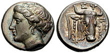
[7] The commercial influence of these city-states is evident in the fact that the Euboic scale of weights and measures was used among the Ionic cities generally, and in Athens until the end of the 7th century BC, during the time of Solon.
[3] The classicist Barry B. Powell has proposed that Euboea may have been where the Greek alphabet was first employed, c. 775–750 BC, and that Homer may have spent part of his life on the island.
Euboea was an important source of grain and cattle, and controlling the island meant Athens could prevent invasion and better protect its trade routes from piracy.
Euboea participated in Greek affairs until it fell under the control of Philip II of Macedon after the Battle of Chaeronea in 338 BC.
Unlike much of Byzantine Greece, Euboea was spared the bulk of the barbarian raids during late antiquity and the early medieval period, due to its relatively isolated location.
On 12 July 1470, during the Ottoman–Venetian War of 1463–1479 and after a protracted and bloody siege, the well-fortified city of Negroponte (Chalcis) was wrested from Venice by Mehmed II and the whole island fell into the hands of the Ottoman Empire.
[16] According to Johann Georg Von Hahn (1854), Albanians were present in all of the cities of southern Euboea, excluding the town of Karystos which was inhabited solely by Greeks.
[20] Although the name Negroponte remained current in European languages until the 19th century, the Turks themselves called the city and the island Eğriboz or Ağriboz after the Euripos Strait.
[10] In 1982, in the Greek-speaking village of Antia in southern Euboea, the entire population knew the local whistled language called sfyria (from the Greek word sfyrizo 'whistle'),[21] but only a few whistlers remain in the 21st century.
[22] Sfyria is "a whistled version of spoken Greek, in which letters and syllables correspond to distinct tones and frequencies.
The promontory of Canaeum, which lies opposite the Malian Gulf, together with the neighbouring coast of Trachis, was the scene of the events connected with the death of Heracles, as described by Sophocles in the Trachiniae.
[2] Based on the records of the 2nd century AD geographer Pausanias, it is suspected that the Titan god Crius is an indigenous deity.
As a whole the Euboeans share a cultural identity similar to that of the people in the rest of Central Greece and speak a southern variety of Greek.
[25] Sarakatsani and Vlachs could be found mainly in the mountainous areas in central and northern Euboea respectively, but nowadays they have abandoned the nomadic way of life and live permanently in the towns and villages across the island.
Marble is mined 3 km (2 mi) north of Eretria which include Marmor Chalcidicum and asbestos in the northeastern part of Carystus in the Okhi mountain.