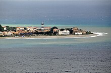
Faro Point
[4] The actual headland of Pelorus, now called the Capo del Faro, is a low, sandy point; but about 3 km from its extremity there begins a ridge of hills which quickly rises into a range of mountains, of no great elevation, but steep and strongly marked.
These continue in an unbroken range at the back of Messina, near which they attain a height of about 1000 m, and flank the east coast of the island as far as the neighborhood of Taormina, where they turn abruptly to the west and stretch across in that direction without any real interruption, until they join the more lofty group of the Monte Madonia.
It is to this range of mountains that the name of "Mons Neptunius" is applied by Solinus called today mounts Peloritani,[5] and which that author describes as separating the Tyrrhenian and Adriatic (i.e. Sicilian) seas.
[7] Again, during the siege of Messana by the Carthaginians: at the commencement of the First Punic War; it was at Pelorus that their fleet was stationed, with the view both of threatening the city and preventing the Romans from crossing the straits.
[9] The actual promontory of Pelorus, as already mentioned, is a low spit or point of sand, about 3 km in length, which has evidently been thrown up by the currents, which flow with great rapidity through the straits.