Ferdows
Ferdows is on the main axis connecting Yazd, Kerman, Isfahan, Bushehr, Hormozgan and Fars provinces to Mashhad.
There is an unproven theory that the town's name in ancient days was "Taban" (or shining; تابان in Persian).
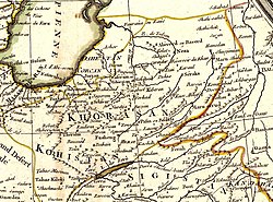
Marco Polo mentioned the south Khorasan region as Toonoqaen, apparently in reference to the two largest cities, Toon and Qaen.
The climate is mild in the spring, hot in the summer, cool and rainy in autumn, and cold in the winter.
Being located near deserts, the temperature difference between day and night, and also between summer and winter, is relatively high.
He believes in the district of Ferdows with beautiful sightseeing and tourist destinations, investing his money there for many years.