Field (geography)
Synonymous terms include spatially dependent variable (geostatistics), statistical surface ( thematic mapping), and intensive property (physics and chemistry) and crossbreeding between these disciplines is common.
During the 1980s, the maturation of the core technologies of GIS enabled academics to begin to theorize about the fundamental concepts of geographic space upon which the software seemed to be based.
[16] A parallel concept that has received less publicity, but has underlain geographic theory since at least Alexander von Humboldt is spatial association, which describes how phenomena are similarly distributed.
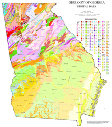
A continuous field has a continuous (real number) domain, and typically shows gradual change over space, such as temperature or soil moisture; a discrete field,[18] also known as a categorical coverage[19] or area-class map,[20] has a discrete (often qualitative) domain, such as land cover type, soil class, or surface geologic formation, and typically has a pattern of regions of homogeneous value with boundaries (or transition zones) where the value changes.
Every such transformation requires Interpolation to estimate field values between or within the sample locations, which can lead to a number of forms of uncertainty, or misinterpretation traps such as the Ecological fallacy and the Modifiable areal unit problem.