Flathead Indian Reservation
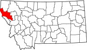
[3] The Flathead Indian Reservation, west of the Continental Divide, consists of 1,938 square miles (5,020 km2) (1,317,000 acres (533,000 ha)) of forested mountains and valleys.
[6] Kootenai groups stretch north and west into what is now Idaho and Canada, with only the southeastern Ksanka band being primarily connected to the Flathead Reservation.
State game wardens were responsible for a violent confrontation in 1908 with a small Pend d'Oreilles hunting party, which resulted in deaths of four of the Native Americans, in what is known as the Swan Valley Massacre.
[13] Most tribal members chose land close to the mountains where wild game still roamed, so prime farmland in the middle of the valleys was available.
With the rugged mountains and valleys, numerous waterways diverse in size, and a large amount of natural lakes, the project was not completed until 1963.
[10] Under the Indian Self-Determination and Education Assistance Act of 1975, the tribal council was finally able to begin gradually taking over management of law enforcement,[17] justice, forestry, wildlife, and health and human services programs.
[15]: 34 [10] Their bid to take over the federal operating license for Kerr Dam wasn't successful, but the tribes obtained exclusive rights to purchase the facility in 2015, and a larger rent payment.
[20] The use of the irrigation project by both Tribal and non-tribal members also complicated the nearly 2-decades-long-statewide effort to negotiate water rights settlements with all of Montana's tribes.
[26] The Montana Water Rights Protection Act, passed by Congress to approve the compact, provided funding to rebuild the Flathead Irrigation Project.
Mission Valley is centrally located within the reservation and surrounded on the eastern, western, and southern sides by mountain ranges.
[31] The southern end of the Mission Mountains includes a large grizzly bear protection area which is usually closed to hikers from July thru September.
[10] The Natural Resource Department uses innovative management to restore and protect the habitat that supports a large variety of wildlife.
[33] The tribe permits hunting by non-natives of the following birds: Hungarian partridge, pheasants, ducks, geese, mergansers, and coots.
[34] At the beginning of August 2023, tribal, state and federal firefighters fought four lightning-sparked wildfires that burned more than 16,000 acres (6,500 ha).
[43] The initial herd for the range, obtained from local ranchers, were the same animals (or their direct descendants) that had previously flourished on the reservation after being gathered by tribal members.
[41] U.S. Department of the Interior Assistant Secretary Tara Katuk Sweeney stated that "The CSKT have strong and deep historical, geographic and cultural ties to the land and the bison, and their environmental professionals have been leaders in natural resources and wildlife management for many decades.
[46] The tribes derive income from selling timber and from operating a variety of businesses: Mission Valley Power Company serves the reservation.
[10] The Confederated Salish and Kootenai Tribes of the Flathead Reservation operate and maintain Mission Valley Power, a federally owned electricity provider.
[54][19] U.S. Highway 93 is a busy route passing through the reservation with Missoula to the south and Glacier National Park and the Whitefish Mountain Resort to the north.
[55] With concern for the nearby designated wilderness and grizzly bear habitat in the Mission Mountains, an agreement with the state and the Federal Highway Administration was reached in December 2000.