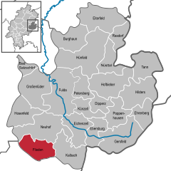
Flieden
It is an area of low hills with the highest elevations being Knöschen near Buchenrod (509 m) and the Storker Küppel near Oberstork (470 m).
Besides the main locality, Flieden consists of the districts Berishof, Buchenrod, Döngesmühle, Federwisch, Fuldaische Höfe, Höf und Haid, Katzenberg, Kautz, Kellerei, Keutzelbuch, Langenau, Laugendorf, Leimenhof, Magdlos, Rückers, Schweben, Stork (Ober- and Unterstork), Storker Hof, Struth and Weinberg.
In the Middle Ages Flieden was located at the Via Regia from Frankfurt am Main to Leipzig which was a very important country and military road in the Holy Roman Empire.
Tunnel-building technology had improved significantly by the beginning of the 20th century, notably with the increased availability of dynamite.
At the end of World War II about 1000 displaced persons from the former eastern territories of Germany settled in Flieden.