Fort Chiswell, Virginia
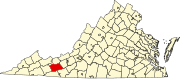
Fort Chiswell is a census-designated place (CDP) in Wythe County, Virginia, United States.
The community name is derived from a frontier fort built in 1758 as an outpost during the French and Indian War.
The fort, which was of strategic importance during the American Revolution as the guardpost over a small deposit of lead used to mold bullets, was situated at the junction of the Great Trading Path and the Richmond Road, near the New River.
The remaining foundations of the Fort and its surrounding buildings were completely covered over during the construction of I-77 in Wythe County during the 1970s.
There is a pyramid shaped historical marker of sandstone situated approximately 200 yards west-northwest of the fort's original location.
[4] According to the United States Census Bureau, the CDP has a total area of 12.1 square miles (31.3 km2), all land.