Interstate 170 (Maryland)
The freeway was originally planned to be the eastern terminus of I-70 and, later, a link between I-70 and the west side of Downtown Baltimore.
I-170 would have begun at a directional T interchange with I-70 where Baltimore Street and Amtrak's Northeast Corridor cross Gwynns Falls.
However, the spur was left stranded from the rest of the Interstate Highway System by the cancellation of I-70 within the city limits of Baltimore.
The route in the proposal (then designated as I-70N) would have begun in the western edge of the city, passing through Gwynns Falls/Leakin Park.
It would have then curved south into the Pratt Street corridor and crossed the city to the north of the Inner Harbor on an elevated viaduct within the central business district, junctioning I-83 and I-95 in the southeast edge of Downtown Baltimore.
In the 3-A system, I-170 was brought into existence, and was planned as a freeway spur from I-70 (which would continue south toward the current alignment of I-95) through the Franklin–Mulberry street corridor formerly followed by the East–West Expressway to the west edge of the central business district, connecting to a new route named Harbor City Boulevard (now known as Martin Luther King Jr. Boulevard).
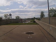
The wide median space was originally reserved for a once-proposed branch of the Baltimore Metro SubwayLink system; this rail line was never built, and more recent plans for the Red Line, a proposed light rail corridor that would have been built by 2016 (but was canceled in 2015) would have made use of the median.
The remaining section of the highway is still key to the Red Line project that was canceled by Governor Larry Hogan in 2015, but then revived by his successor Wes Moore in 2023.
[11] A similar project was the destruction of the Inner Loop Highway in Rochester, from November 2014 to December 2017 and partially funded by a Transportation Investment Generating Economic Recovery grant; it was replaced by new apartment buildings, shops, and restaurants.