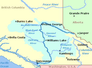
Fraser Valley
It starts just west of Hope in a narrow valley encompassing the Fraser River and ends at the Pacific Ocean stretching from the North Shore Mountains, opposite the city of Vancouver BC, to just south of Bellingham, Washington.
This overstepping of jurisdiction inevitably led to conflict as Great Britain was incapable of exercising the control they claimed over the river valley.
This war was part of a series of local conflicts surrounding the arrival of settlers ahead of American and British capacity to maintain order and refusal to cooperate with or recognize indigenous land claims and demands.
The interaction of indigenous peoples and settlers led to the growth of Chinook Wawa, a pidgin language that was used throughout the Fraser River Valley until the early 1900s.
Industrialization of the river began with the use of the traditional trade waterway by steamboats and eventually, roads and railways were built, fueled by and in turn fuelling further population growth.
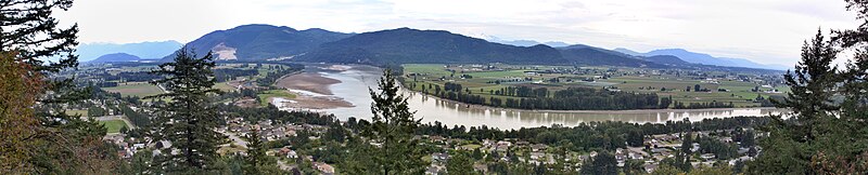
Downstream from Hope, the river and adjoining floodplains widen considerably in the area of Rosedale, Chilliwack and Agassiz, which is considered the head of the Fraser Delta.
From there the river passes through some of the most fertile agricultural land in British Columbia—as well as the heart of the Metro Vancouver region—on its way through the valley to its mouth at Georgia Strait.
The valley is the largest landform of the Lower Mainland ecoregion, with its delta considered to begin in the area of Agassiz and Chilliwack, although stretches of floodplain flank the mountainsides between there and Hope.
Lanes of convective ocean-effect clouds and showers are produced as heat and moisture modify the very dry, frigid air mass.
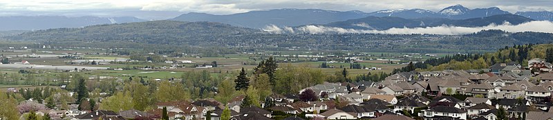
[18] Today, the Fraser Valley has a mix of land uses, ranging from the urban and industrial centres of Vancouver, Surrey, and Abbotsford through golf courses and parks to dairy farms and market gardens.
Comparative data on four measures—fine particulate matter, ground-level ozone, nitrogen dioxide and sulphur dioxide—shows the Fraser Valley to have better air quality than Vancouver on several measures.
[21] In certain weather conditions during the summer, prevailing westerly winds blow air pollution from vehicles and from ships in Vancouver harbour east up the triangular delta, trapping it between the Coast Mountains on the north and the Cascades on the southeast.
The south shore of the Central and Upper Fraser Valley is also known colloquially as the "Bible Belt" of British Columbia and is home to many of Canada's largest churches, notably the Mennonite Brethren and the Dutch Reformed Church, a reflection of the heavy settlement of the Valley by post-war Dutch and German immigrants, as well as the Canadian headquarters of many Christian/Evangelical para-church organisations such as Focus on the Family and Power to Change, the Canadian branch of Cru_(Christian_organization), formerly known as Campus Crusade for Christ.