Freeport, New York
[5][7][8] In 1853, residents voted to rename the village Freeport, adopting a variant of a nickname used by ship captains during colonial times because they were not charged customs duties to land their cargo.
This trade began to decline as early as the beginning of the 20th century because of changing salinity and increased pollution in Great South Bay.
[6] Nonetheless, even as of the early 21st century Freeport and nearby Point Lookout have the largest concentration of commercial fishing activity anywhere near New York City.
From 1902 into the late 1920s, the New York and Long Island Traction Corporation ran trolleys through Freeport to Jamaica, Hempstead, and Brooklyn.
For a few years after 1913, the short-lived Freeport Railroad Company ran a trolley nicknamed "the Fishermen's Delight" along Grove Street (now Guy Lombardo Avenue) from Sunrise Highway to the waterfront.
At the time, travel from Freeport to New York City required a journey of several hours on a coal-powered train, or an even more arduous automobile trip on the single-lane Merrick Road.
According to Elinor Smith, the arrival of Diamond Jim Brady and Lillian Russell around the start of the 20th century marked the beginning of what by 1914 would become an unofficial theatrical artists' colony, especially of vaudeville performers.
[14] Freeport's population was largest in the summer season, during which most of the theaters of the time were closed and performers left for cooler climes.
[15] Leo Carrillo and Victor Moore were early arrivals,[16] later joined by Fannie Brice, Trixie Friganza, Sophie Tucker, Harry Ruby,[17] Fred Stone, Helen Broderick, Moran and Mack, Will Rogers, Bert Kalmar, Richard Whiting, Harry von Tilzer, Rae Samuels, Belle Baker, Grace Hayes, Pat Rooney, Duffy and Sweeney, the Four Mortons, McKay and Ardine, and Eva Tanguay.
[16] Several of Freeport's actors gathered together as the Long Island Good Hearted Thespian Society (LIGHTS), with a clubhouse facing onto Great South Bay.
According to a story in Newsday detailing the history of Long Island,often, respected clergymen and public officials openly supported the Klan and attended its rallies.
On Sept. 20, 1924, for instance, the Klan drew 30,000 spectators to a parade through Freeport – with the village police chief, John M. Hartman, leading a procession of 2,000 robed men.... the founding of one of Long Island's first klaverns, in Freeport, was memorialized on Sept. 8, 1922, in the Daily Review, which carried a banner headline about the meeting at Mechanics Hall on Railroad Avenue.
Fred and Mirto Scopinich operated their boatyard in Freeport from just after World War I until they moved it to East Quogue in the late 1960s.
One of these, a 26-footer, carried Grover and his sons from Nova Scotia to Portugal in 1985, the first-ever crossing of the Atlantic Ocean by a boat powered by an outboard motor.
Among this company's achievements was the propeller for the USS Nautilus, an operational nuclear-powered submarine and the first vessel to complete a submerged transit across the North Pole.
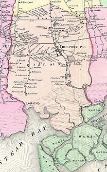
[27] The south part of the village is penetrated by several canals that allow access to the Atlantic Ocean by means of passage through salt marshes.
The demographics were as follows:[31] At the 2020 American Community Survey, the Latino population was 16.2% Dominican, 9% Salvadoran, 4.2% Puerto Rican, 3% Guatemalan, 2.2% Colombian, 1.7% Ecuadorian.
A popular festival occurs on Freeport's Nautical Mile (the west side of Woodcleft Canal) the first weekend in June each year, which attracts many people from across Long Island and New York City.
The Nautical Mile is a strip along the water that features well-known seafood restaurants, crab shacks, bars, eclectic little boutiques, fresh fish markets, as well as party cruise ships and casino boats that float atop the canals.
People line up for the boat rides and eat at restaurants that feature seating on the water's edge and servings of mussels, oysters, crabs, and steamed clams ("steamers") accompanied by pitchers of beer.
The Sea Breeze waterfront park—which includes a transient marina, boardwalk, rest rooms and benches—opened in 2009 at the foot of the Nautical Mile.
Freeport's Hispanic community is made up of Puerto Ricans, Dominicans, Mexicans, Colombians and other Latin American countries.
Freeport is a 45-minute ride by the Long Island Rail Road to Manhattan, making the trip an easy commute to New York City.
[41] Just north of the high school and the railroad tracks is the ruin of the former Brooklyn Waterworks, described by Christopher Gray of the New York Times as looking like an "ancient, war-damaged abbey."
Long Island Traditions also describes the sites of notable architecture in Freeport's history, such as bay men's homes[44] and commercial fishing establishments,[45] some of which are still existing, as well as the still-existing Fiore's Fish Market and Two Cousins, which are located in historic waterfront buildings, built by the owners, so they could negotiate directly with the baymen as they pulled into dock.
One unique feature of the school's curriculum is a science research program run in cooperation with Stony Brook University.
[52][53] That last decision was turned back by the school board after it drew attention from, among others, The New York Times and the Student Press Law Center.
Much credit for the team and computers goes to FHS math teachers and to the Freeport School District's head of Mathematics, Joseph Holbrook.
[54] In a 2010 Newsday story regarding Long Island eighth-grader scores on Regents Exams, which have traditionally been given to students in ninth grade and up, Freeport was ranked in the highest tier.
For a few years after that, the NFL's Brooklyn Dodgers football team, which, like their baseball namesakes, played at Ebbets Field, using the stadium as a midweek training site.