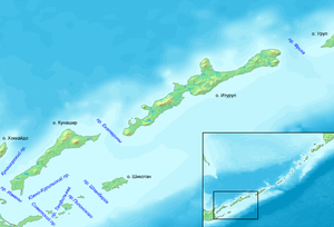
Vries Strait
It is located between the northeastern end of the island of Iturup and the southwestern headland of Urup Island, connecting the Sea of Okhotsk on the west with the Pacific Ocean on the east.
[1] Sometimes credited with making the first European contact with Urup and Iturup, he actually recorded exaggerated nonsense or phantom islands, claiming the region held the enormous continental Company Land—named after the VOC—and the large and prosperous Staten Island, named after the States General.
However, they both survived on European maps of the region for well over a century, even after Vitus Bering's lieutenant Martin Spanberg disproved their existence in anything like Vries's account.
[2][3] Nonetheless, having survived for so long on so many maps, the name was carried over to describe the extant strait between the actual islands in the area.
The strait forms a major division in the plantlife of the Kurils, called the Miyabe Line (Japanese: 宮部線, Miyabe-sen) by the Japanese botanist Kingo Miyabe.